|
|
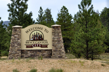
Bryce Canyon National Park is located in southwestern Utah. The major feature of the park is Bryce Canyon which, despite its name, is not a canyon but a collection of giant natural amphitheaters along the eastern side of the Paunsaugunt Plateau.
 Bryce
is distinctive due to geological structures called hoodoos,
formed by frost weathering and stream erosion of the river and lake
bed sedimentary rocks. The red, orange, and white colors of the rocks
provide spectacular views for park visitors. Bryce sits at a much higher
elevation than nearby Zion National Park. The rim at Bryce varies from
8,000 to 9,000 feet. Bryce
is distinctive due to geological structures called hoodoos,
formed by frost weathering and stream erosion of the river and lake
bed sedimentary rocks. The red, orange, and white colors of the rocks
provide spectacular views for park visitors. Bryce sits at a much higher
elevation than nearby Zion National Park. The rim at Bryce varies from
8,000 to 9,000 feet.
 The
Bryce Canyon area was settled by Mormon pioneers in the 1850s and was
named after Ebenezer Bryce, who homesteaded in the area in 1874. The
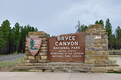
area around Bryce Canyon became a U.S. National Monument in 1923 and
was designated as a national park in 1928. The park covers 35,835 acres
(55.99 square miles). The
Bryce Canyon area was settled by Mormon pioneers in the 1850s and was
named after Ebenezer Bryce, who homesteaded in the area in 1874. The
area around Bryce Canyon became a U.S. National Monument in 1923 and
was designated as a national park in 1928. The park covers 35,835 acres
(55.99 square miles).
|
|
|
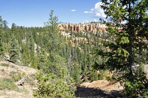
Although a tram is available, the two RV
Gypsies decided to drive their own truck on the 37-mile round-trip drive
to Bryce Canyon's most popular viewpoints. It was a short walk from
the parking lots to the view points, and Lee Duquette did NOT want to
do any heavy duty hiking because it was a very hot day, although there
are lots of hiking trails throughout Bryce Canyon National Park. |
|
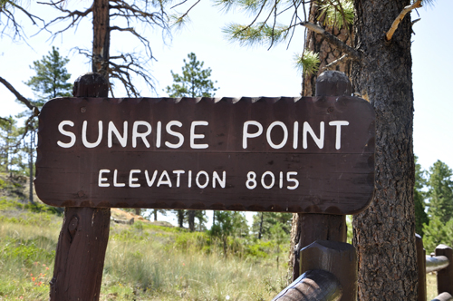
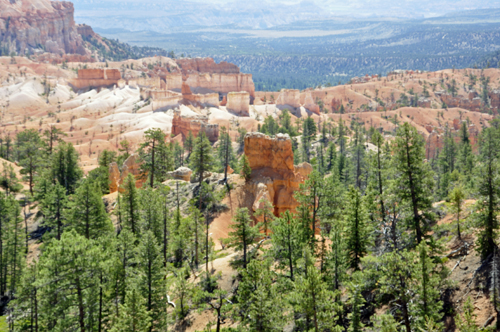
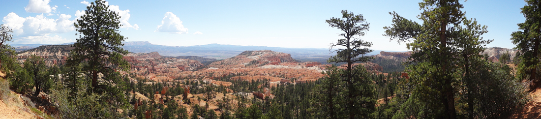
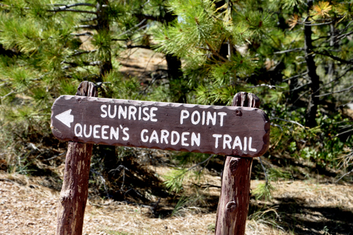
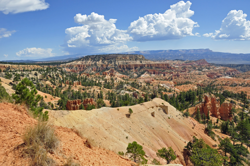
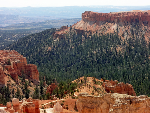
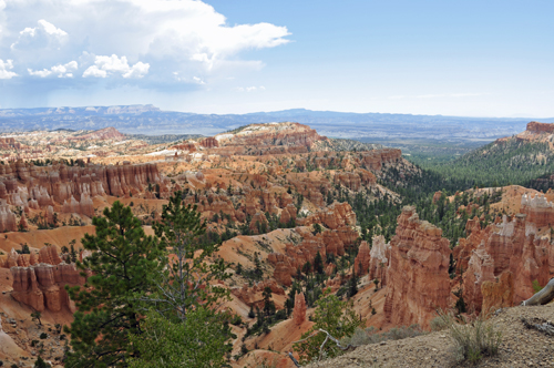
Below: The two RV Gypsies
found their first view of Bryce Canyon to be dramatic with rows of pine
trees that veiled the color and grandeur of the canyon until they reached
the rim after a short walk from the parking lot to Sunrise Point. Here
the brilliant hues came alive. |
|
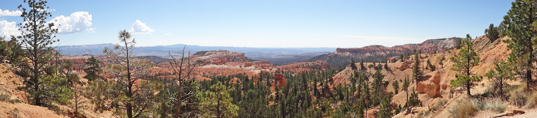
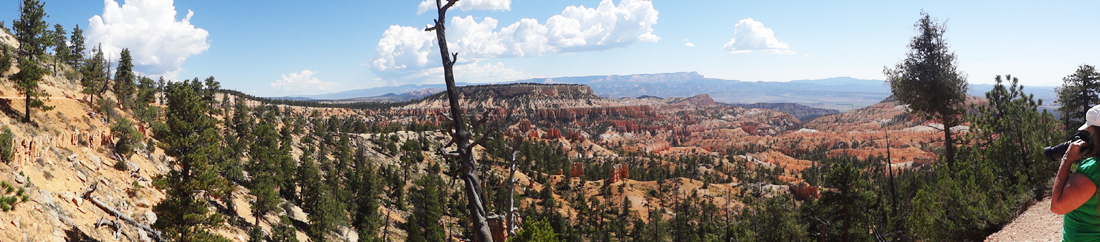
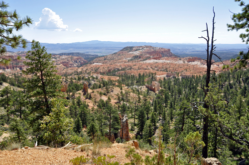
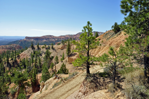
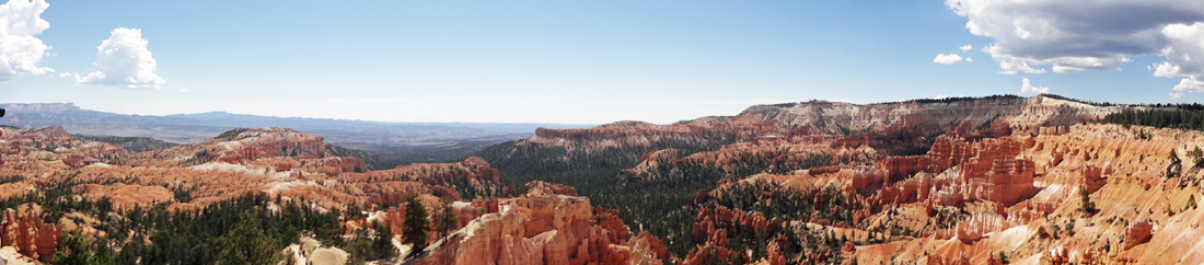
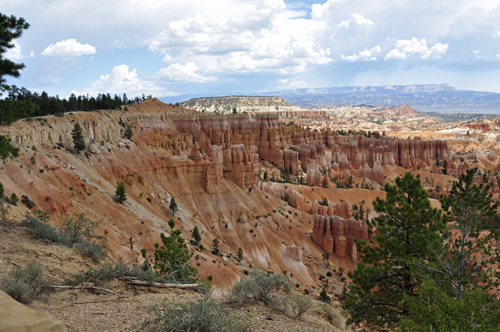
Below: The view to the northeast from Sunrise
Point captures Boat Mesa and the Sinking Ship, set
against the stark pink cliffs of the Aquarius Plateau. |
|
|
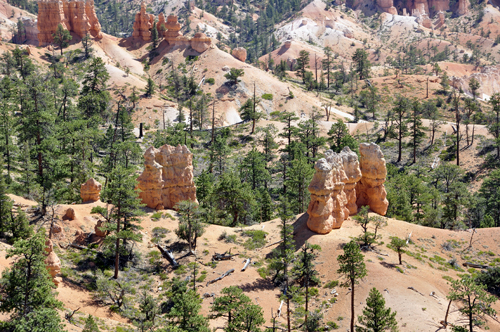
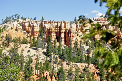
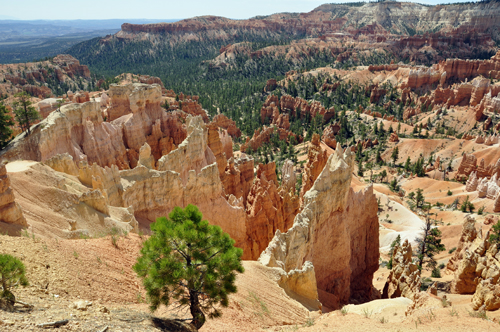
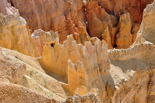
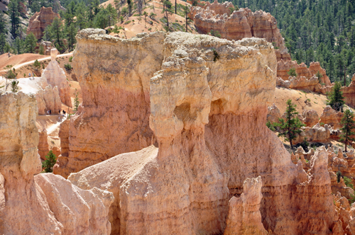
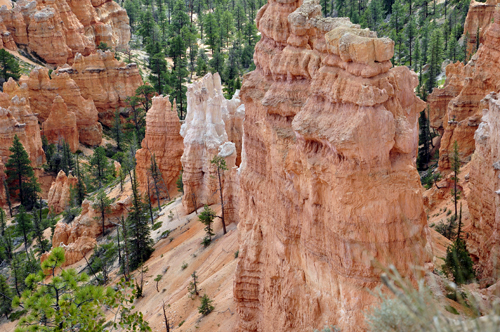
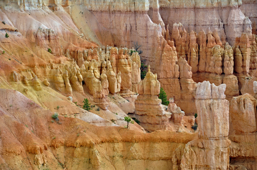
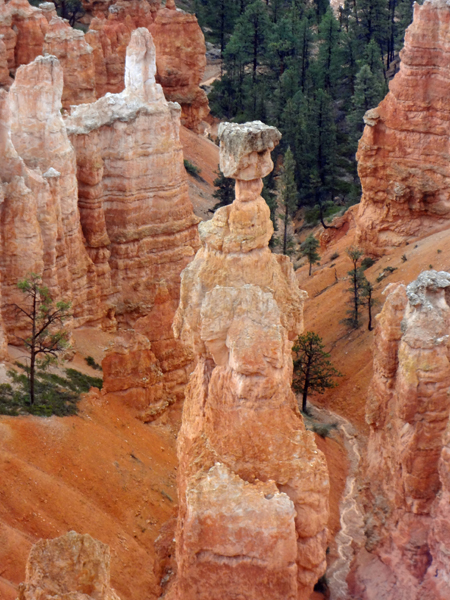
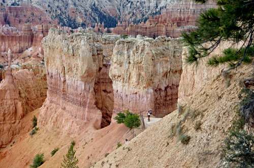
Below: It is
the uniqueness of the rocks that caused Bryce Canyon to be designated
as a National Park. These famous spires, called "hoodoos,"
are formed when ice and rainwater wear away the weak limestone that
makes up the Claron Formation. |
|
|
|
|
|
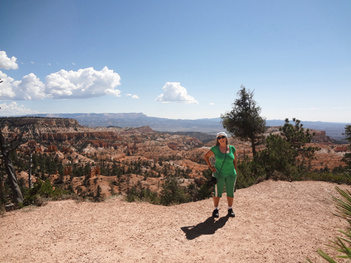
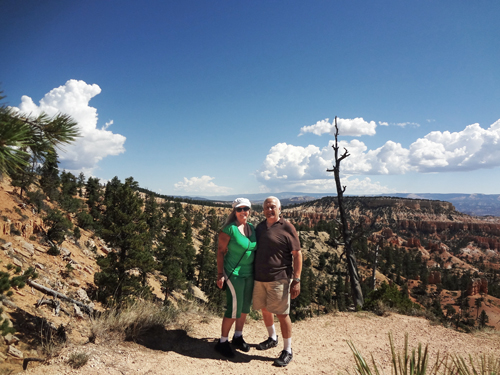
Below: Karen and Lee Duquette
at Sunrise Point in Bryce Canyon |
|
|
|
|
|
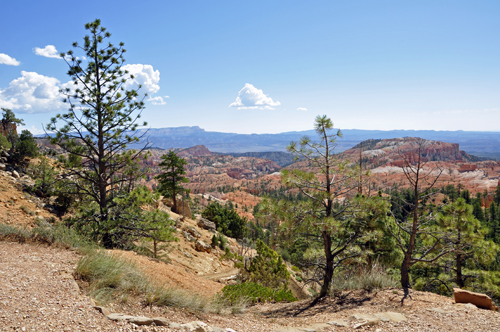
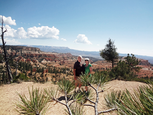
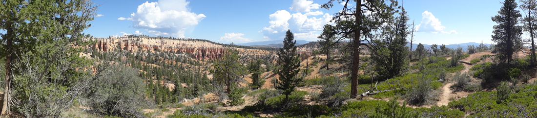
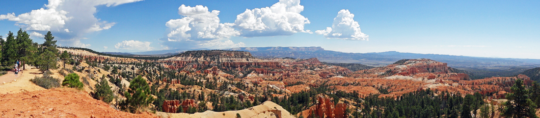
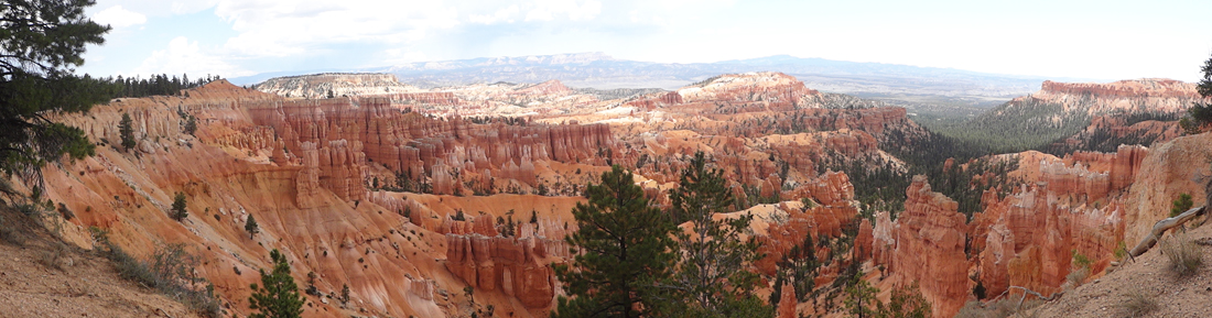
Below: Looking south from Sunrise Point |
|
|
|
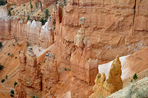
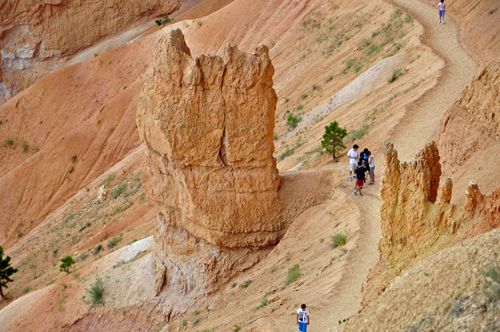
Below: Queen's Garden Trail is an easy to
moderate trail that descends into a section of hoodoos ruled by the
Queen Victoria hoodoo. The two RV Gypsies only walked the first
few feet of the easy part so they did not get to see the Queen Victoria
hoodoo, yet they still got some wonderful photos and were pleased
with their choice. |
|
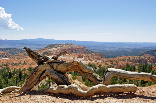
Below: The Limber Pine at Sunrise Point,
roots exposed by erosion of the rim, serves as a reminder of the resilience
and ability of life to adapt to adverse conditions, and also of the
rapidity with which the scene before us is disappearing. Geologists
have calculated that the rim of the canyon is eroding at a rate of two
to four feet every century and that in approximately three million years,
Bryce Canyon will be gone forever. |
|
|
|
|
|
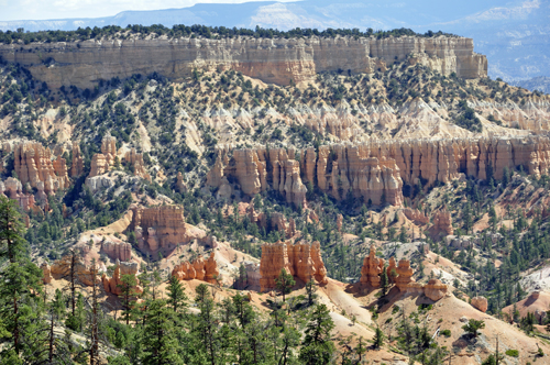
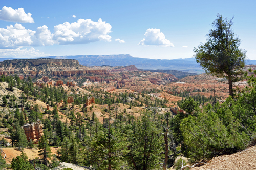
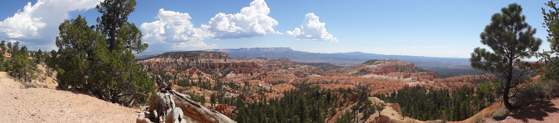
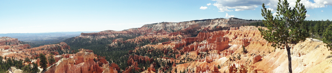
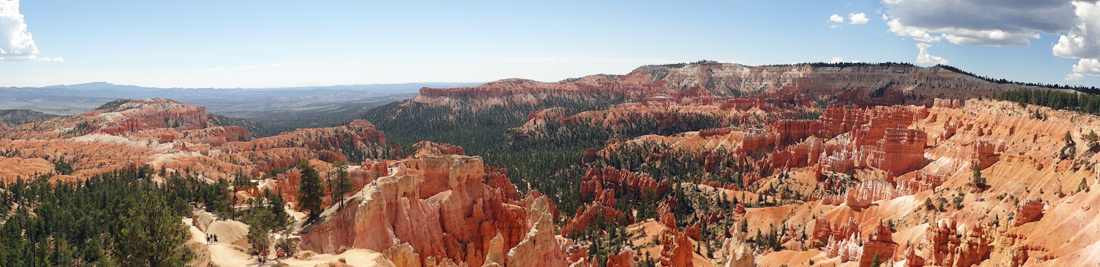
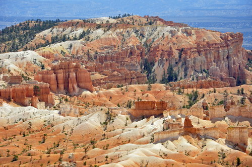
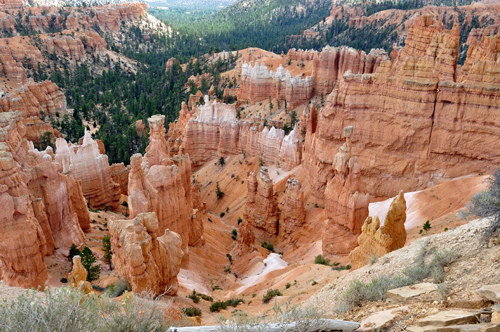
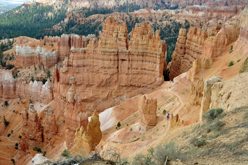
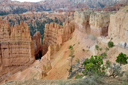
Below: The main amphitheater
has four primary viewpoints - Sunrise, Sunset, Inspiration, and Bryce
Points - and all of them are connected by The Rim Trail. Below is an
area known as The Queen's Garden located below Sunrise Point. |
|
|
|
|
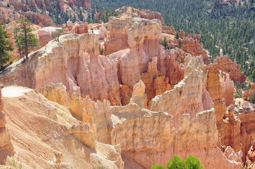
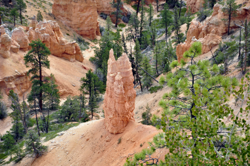
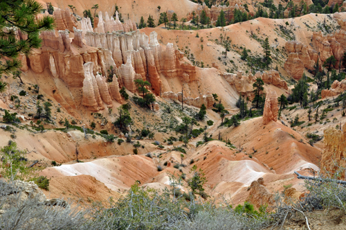
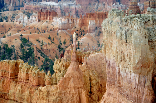
Below: Thanks to Karen Duquette's
zoom lens on her camera, some great close-ups of the hoodoos were captured. |
|
|
Below: There were so many hoodoos at Bryce Canyon, so
most of the hoodoos do NOT have names. |
|
Below: The geologic term, hoodoo,
lives on at Bryce Canyon National Park as perpetuated by early geologists
who thought the rock formations could cast a spell on you with their
magical spires and towering arches. |
|
|
|
|
|
|
|
|
|
|
|
|
|
|
|
|
|
|
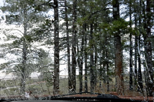
Below: Suddenly
it started to rain hard so Lee and Karen Duquette ran to their car and
ate lunch in their car. They were glad they did not take the shuttle
bus or they would not have had any shelter or place to eat their lunch.
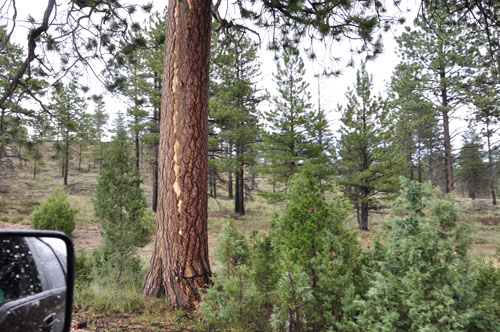
Below: After the storm ended, Karen Duquette spotted
a tree that was hit by Lightning sometime in the past, so of course
she took a photograph of the tree. |
|
|
Below: Then Lee Duquette continued on to drive on to
see more of Bryce Canyon's most popular viewpoints. See the menu below
for photos. |