|
 |
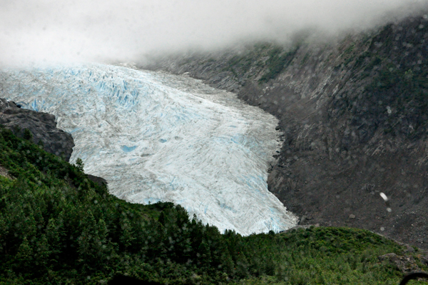
Below: BEAR GLACIER |
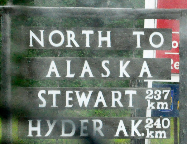
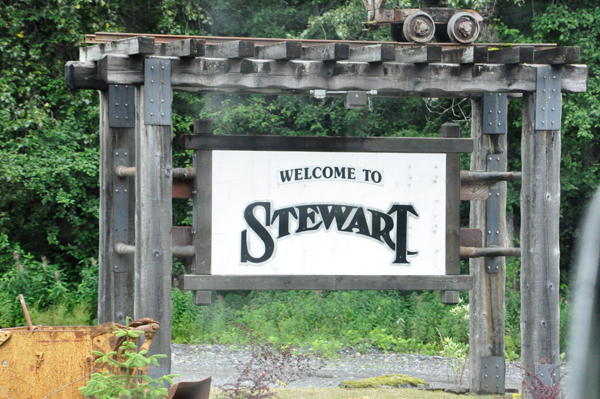
Bear Glacier Park is located on Highway 37A, between Meziadin Junction and Stewart. The closest community, town and city is Stewart. Just a short side trip on Highway 37A towards Stewart, the Bear Glacier descends towards Strohn Lake, down Bear River Pass.
|
 Ice once filled all of Bear River Pass. In the 1940's, Bear Glacier began to retreat and Strohn Lake formed in the exposed basin. Acting as an ice dam, the glacier prevented the lake from draining down the Bear River Valley. If enough water collects behind an ice dam, a glacier may begin to float. Water flowing under the ice quickly creates a large tunnel. The lake empties, the ice dam resettles, and water again begins to collect until another flood is triggered. Five times between 1958 and 1962 Strohn Lake emptied underneath its ice dam in a catastrophic tumult of muddy water, rock and ice. In 1967, Bear Glacier melted away from the valley wall and Strohn Lake was no longer dammed. The threat of sudden destructive icy floods in the Bear River Valley disappeared with the glacier's retreat. Bear Glacier Park was designated as a Class A Provincial Park in 1998. Bear Glacier Park lies within the Nass Wildlife area and protects part of a large glacier and a glacial lake. There is no longer access to Bear Glacier. Ice once filled all of Bear River Pass. In the 1940's, Bear Glacier began to retreat and Strohn Lake formed in the exposed basin. Acting as an ice dam, the glacier prevented the lake from draining down the Bear River Valley. If enough water collects behind an ice dam, a glacier may begin to float. Water flowing under the ice quickly creates a large tunnel. The lake empties, the ice dam resettles, and water again begins to collect until another flood is triggered. Five times between 1958 and 1962 Strohn Lake emptied underneath its ice dam in a catastrophic tumult of muddy water, rock and ice. In 1967, Bear Glacier melted away from the valley wall and Strohn Lake was no longer dammed. The threat of sudden destructive icy floods in the Bear River Valley disappeared with the glacier's retreat. Bear Glacier Park was designated as a Class A Provincial Park in 1998. Bear Glacier Park lies within the Nass Wildlife area and protects part of a large glacier and a glacial lake. There is no longer access to Bear Glacier.
|
|
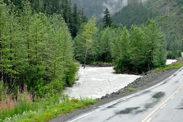
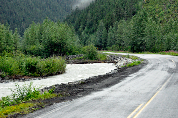
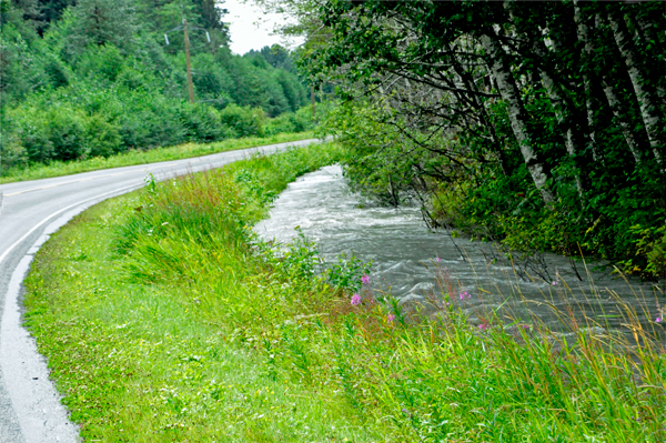
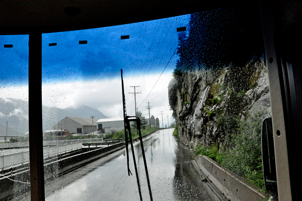
Below: The road followed the fast flowing
river that was often high level and very close to the road. |
 |
 |
 |
 |
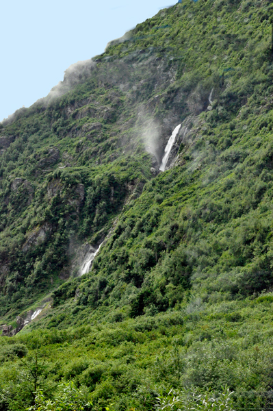
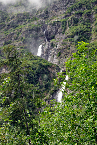
Below: There was nice scenery with several
waterfalls along the road, but when driving a big RV, it is not usually
possible to stop for photos. But Karen Duquette managed to photograph
one waterfall along the way as Lee Duquette drove past it. |
 |
 |
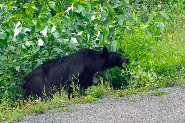
Below: Then Karen Duquette noticed that
cars were stopped in the road. So Lee Duquette had no choice but to
stop too. So Karen Duquette got some nice photos of a bear through the
window of the RV. |
 |
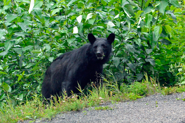 |
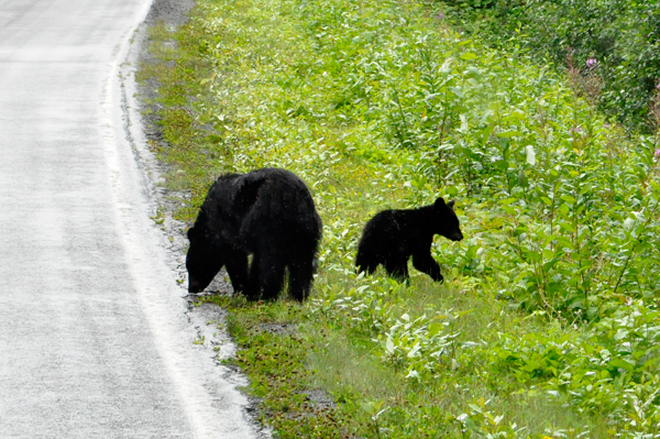
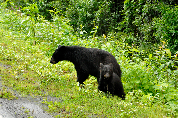
Below: A bit further down the road, the
two RV Gypsies lucked out again because a mama bear and her cub were
right beside the road. There was not any traffic so Lee Duquette stopped
the RV and Karen Duquette took a few photos through the closed window
of the tall RV. (Remember, it is NOT safe to get too close to wildlife,
especially bears) |
 |
 |
Below: A Canada Border Services Agency
customs post is located between Stewart, British Columbia and Hyder
Alaska. It is used by all visitors to Hyder and all Hyder residents
as it provides the ONLY road connecting in or out of Hyder. Customs
did not check cars going into Hyder from Stewart, but did check all
vehicles leaving Hyder and going into Stewart, so a passport was needed.
|
 |
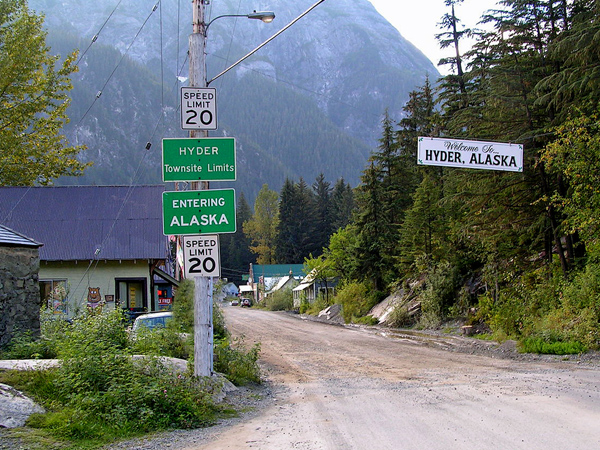
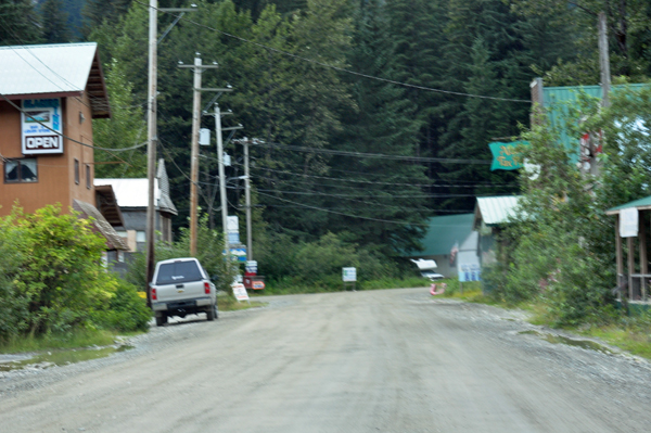
Below: Hyder is a census-designated
place (CDP) in Prince of Wales-Hyder Census Area, Alaska, United States.
The population was 87 at the 2010 census. According to the U.S. Census
Bureau, the CDP has a total area of 14.8 square miles all land. Hyder
has achieved fame as a point in Alaska accessible to automobile and
motorbike travelers in Canada and the USA who want to say that they
have been to Alaska, and as a place to likely see bears.
Hyder is also the easternmost town in Alaska and is located at at the head of the Portland Canal, a 130-mile long fjord which forms a portion of the border between the U.S. and Canada at the southeastern edge of the Alaska Panhandle. It sits about 2 miles from Stewart, British Columbia by road, and 75 miles from Ketchikan by AIR. The only way to reach other parts of Alaska from Hyder is by air, or going back through Stewart, British Columbia, Canada. The AMHS ferry that used to connect Hyder to Ketchikan stopped running in the 1990s, leaving the only public transportation between Hyder and the rest of Alaska the Taquan Air floatplane that arrives twice a week with U.S. Mail at Hyder Seaplane Base. |
|
|
Below: There are few local
services in town; Hyder Water Works, US Forest Service Info Kiosk, Camp
Run-A-Muck, Hyder Community Association home to museum, information
center and library, "This N That Shop", Sealaska
Inn, and the Boundary Gift Store.
Alaska State Troopers patrol the town, but are not located in town.
Policing is sometimes provided by stopovers by the Stewart Royal Canadian
Mounted Police (RCMP) Detachment from the Canadian side. There is no
fire or EMS services in town. When required they are provided by nearby
Stewart. |
| |
Below: As Lee Duquette drove
the RV towards the campground in Hyder, it began to rain. The last time
the two RV Gypsies were in Hyder, they stayed at a campground in Stewart
British Columbia. |
|
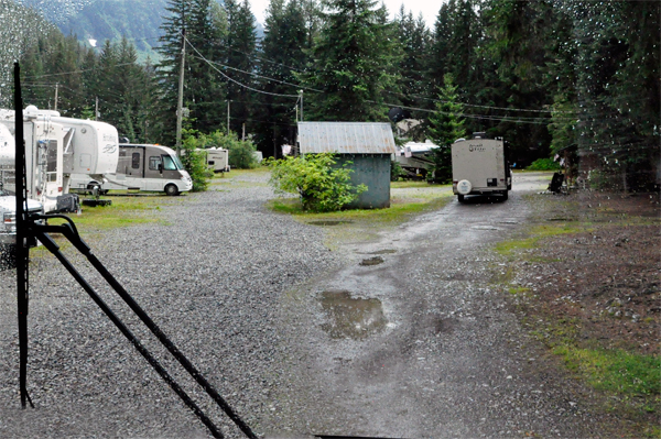
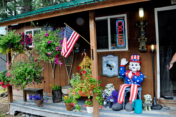
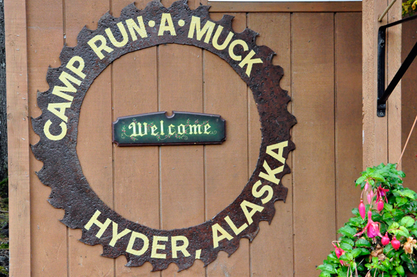
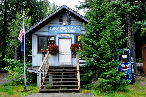
Camp Run-A-Muck is on the left side of the street shortly after entering Hyder, Alaska from Stewart, British Columbia. Border Patrol did not stop traffic arriving into Alaska, but does stop traffic leaving Hyder back into Stewart. When the two RV Gypsies were here in 2009, they stayed at a nice campground in Steward, just before the border. But this time they decided to stay at Camp Run-A-Muck. The Steward campground is a lot nicer.
Camp Run-A-Muck is only 3 miles from the US Forest Service Bear Viewing Bridge and 22 miles from Salmon Glacier.
Camp Run-A-Muck lists U.S. TV Reception as an amenity. They were not
lying, but only ONE TV station came in. It also listed free Wi-Fi and
gave Lee Duquette a code, but it did not connect to the internet at
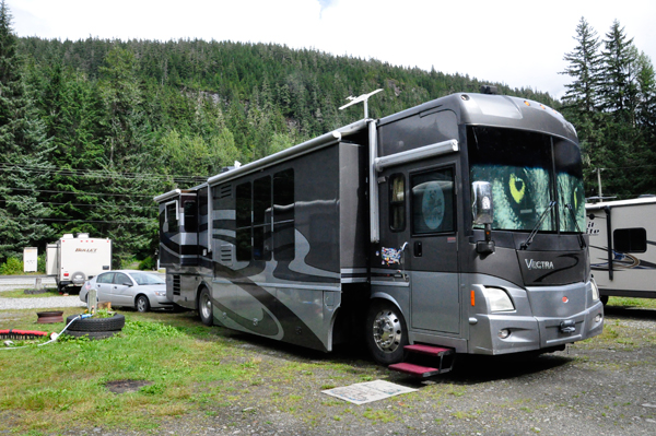
all. The two RV Gypsies did get a pull-thru 30 amp full-hook-up site.
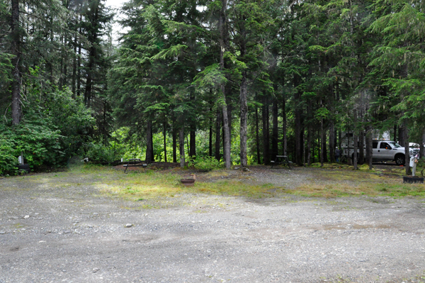
The road and sites are gravel/dirt combination, nothing special. (see
photos below). Other amenities are laundromat, free firewood, secure
24-hour host, shuttle service, fishing and bear viewing information,
book exchange. There are 65 sites total, 52 of which are pull-thru sites.
If the two RV Gypsies used their cell phones it would be considered
roaming charges at $1 a minute. So, they did not even check to see if
their cell phones worked while they were here. |