|
|
 |
 |
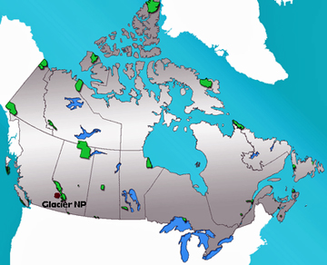
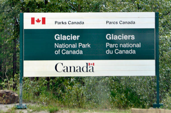
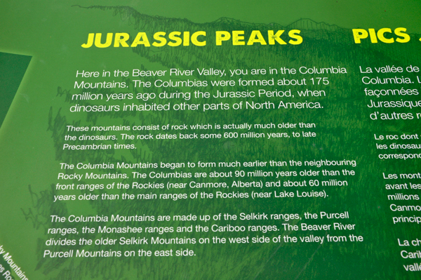
Glacier National Park is one of seven national parks in British Columbia, and is part of a system of 43 parks and park reserves across Canada. Established in 1886, the park encompasses 521 square miles and includes a portion of the Columbia Mountains. It also contains the Rogers Pass National Historic Site.
 The park's history is closely tied to two primary Canadian transportation routes, the Canadian Pacific Railway (CPR), completed in 1885, and the Trans Canada Highway, completed in 1963. The pass eluded explorers until 1881. The railway brought with it tourism, the establishment of Glacier National Park and the construction of a popular alpine hotel (which is currently closed). The heavy winter snows and steep, avalanche-prone valleys of the park have been a major obstacle to transportation, necessitating much railway engineering and avalanche control measures. The park's history is closely tied to two primary Canadian transportation routes, the Canadian Pacific Railway (CPR), completed in 1885, and the Trans Canada Highway, completed in 1963. The pass eluded explorers until 1881. The railway brought with it tourism, the establishment of Glacier National Park and the construction of a popular alpine hotel (which is currently closed). The heavy winter snows and steep, avalanche-prone valleys of the park have been a major obstacle to transportation, necessitating much railway engineering and avalanche control measures.
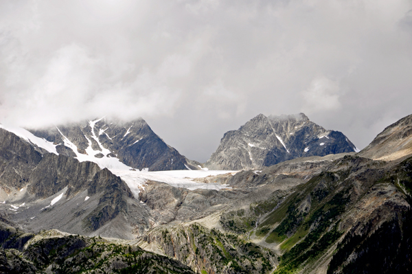
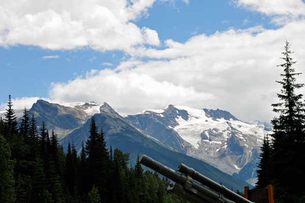
The park contains high peaks, large active glaciers, and one of Canada's largest cave systems. Its dense forests support populations of large mammals, birds, and alpine species. The region is noted for its heavy snowfall. The park has an extensive network of trails, three campgrounds, and four backcountry huts and cabins. Due to the major transportation routes that bisect it, Glacier National Park sees large numbers of visitors. The park has 131 glaciers.
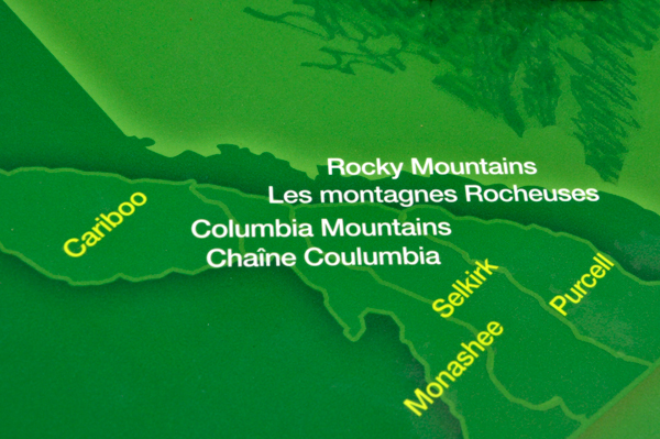
Major peaks and ranges: The highest point in the park is Mount Dawson, at 11,079 feet. Peaks of the Hermit Range, the Bonney and Bostock Groups, the Van Horne Range, Purity Range, Dawson Range, and the precipitous Sir Donald Range all lie wholly or in part within the park. |
 |
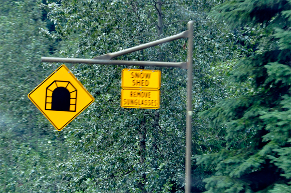
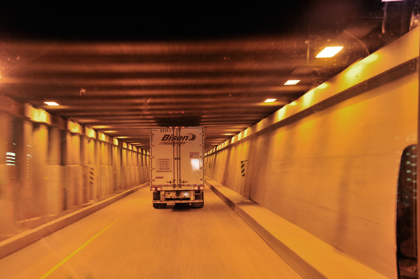
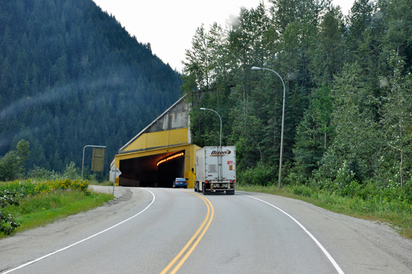
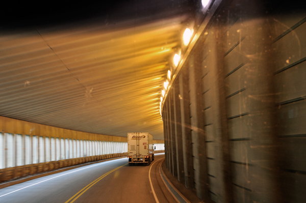
Have you ever heard the term,
“snow shed” and wondered what it is? Well, it is
NOT a place to keep extra snow.
Actually, it’s more like a tunnel, a concrete cover built over
the road to protect traffic from avalanches. Snow sheds are designed
to withstand the incredible forces involved with vast amounts of sliding
snow, however they are not meant to stop it. Instead, the sheds deflect
the snow, allowing it to pass over top while traffic continues to flow
underneath. There are several snow sheds throughout the province, and
Ministry looks after four of them: three on Highway 1 and one on Highway
5 (the Coquihalla). Parks Canada looks after five others, all located
in Glacier National Park by Rogers Pass on Highway 1. |
 |
 |
 |
 |
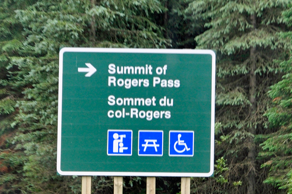
Rogers
Pass: An expedition led by Major Albert Bowman Rogers up the Illecillewaet
led to the discovery of a viable pass in 1881. Rogers was awarded a
five thousand dollar prize for locating a route through the mountains.
By 1885, the Canadian Pacific Railway (CPR) had constructed a line through
Rogers Pass and trains were traveling west to the Pacific for the first
time in Canada. The federal government and the CPR quickly realized
the tourism potential of the mountainous, heavily glaciated area, and
Glacier National Park was established in 1886. Along with Yoho National
Park, also established in 1886, the park was just the second in the
new parks system after Banff National Park, established a year earlier. |
 |
 |
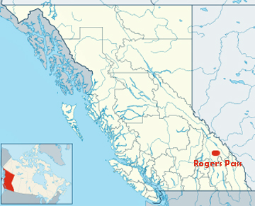
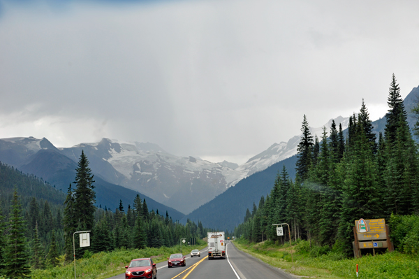
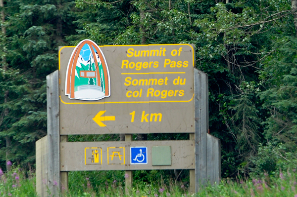
Rogers Pass is a narrow valley
surrounded by a number of mountains. It is formed by the headwaters
of the Illecillewaet River to the west and by the Beaver River to the
east. Both of these rivers are tributaries of the Columbia River, which
loops about 240 km around to the north of the pass. Rogers Pass
(elevation 4,360 feet) is a shortcut across the "Big Bend" of the Columbia
River from Revelstoke on the west to Donald, near Golden, on the east.
The pass was discovered on May 29, 1881, by Major Albert Bowman Rogers,
a surveyor working for the Canadian Pacific Railway. Rogers had a second
pass named for him in 1887 in Montana, 373 miles to the south-east.
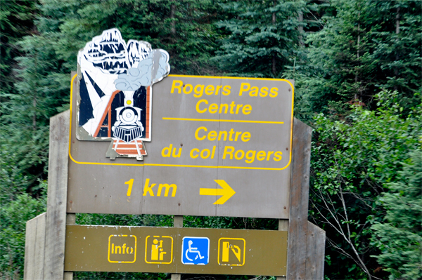
The location has tourist services including the Rogers Pass Discovery
Centre and National Park services. Rogers Pass is commemorated as a
National Historic Site of Canada.
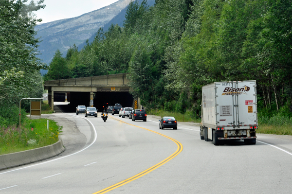
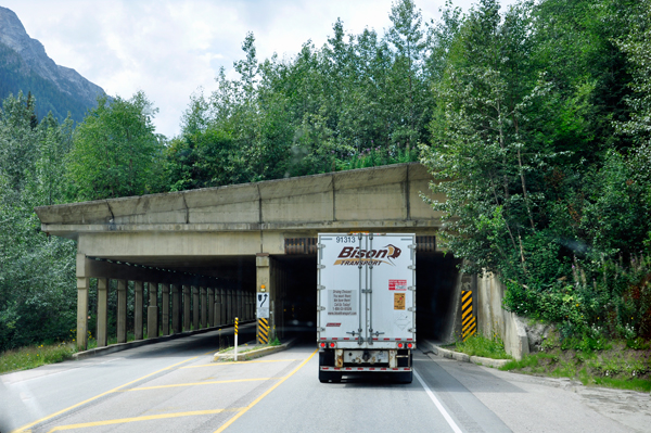
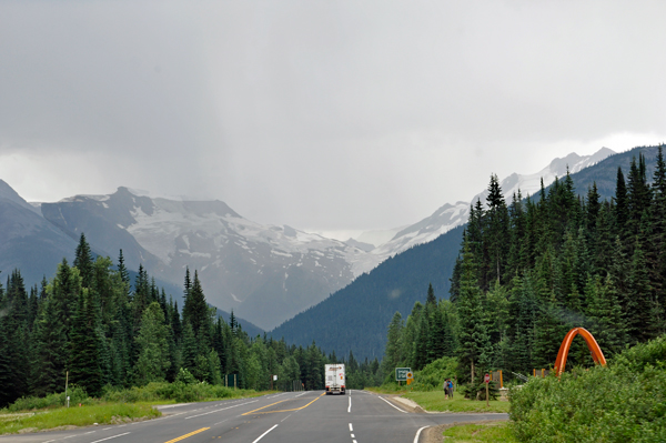
Rogers Pass is known for its winter snowfall, which amounts to about
10 m per year. Because of steep mountains, avalanches are very common
in winter. When the railway first went over the pass, 31 snow sheds
with a total length of about 6.5km were built to protect the railway
from the avalanches. Snow sheds for the Trans-Canada Highway were built
later, including large ones in 1962. |
 |
 |
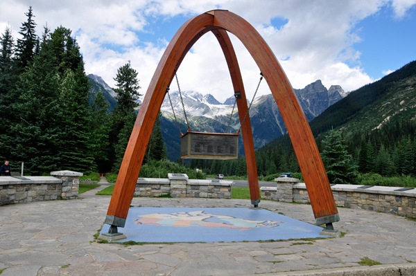
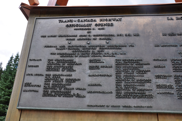
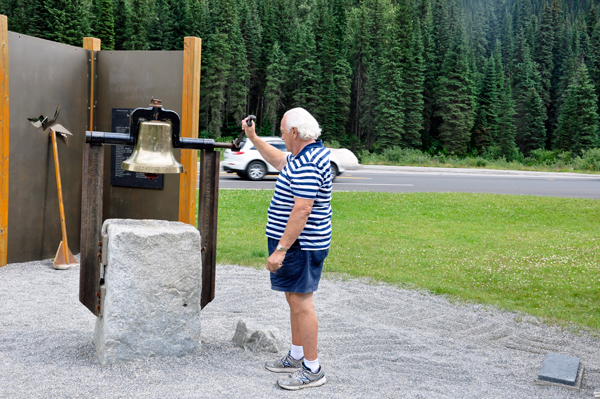
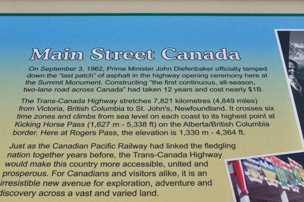
Below: Rogers Pass Monument
Arches - These arches form a part of a monument celebrating the opening
of the road through Rogers Pass which was officially opened on September
3rd, 1962. The major arch represents confederation and the minor arch
represents transportation. |
 |
 |
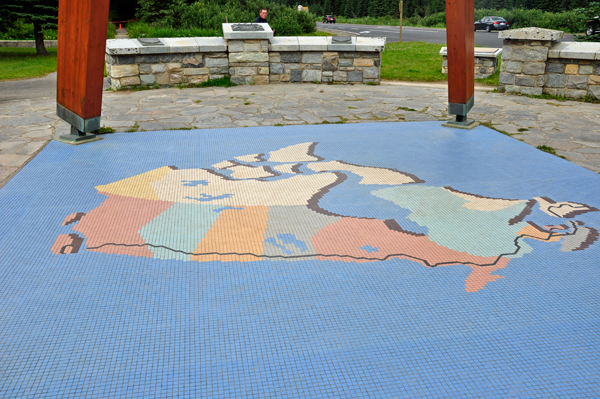
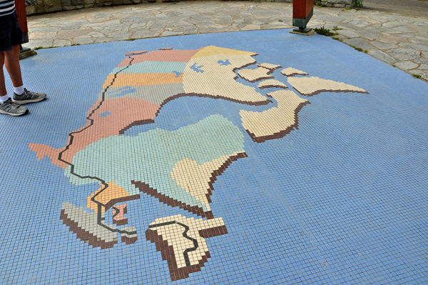
Below: Trans-Canada
Highway map under the Rogers Pass Monument Arches. |
 |
 |
The original highway between
Revelstoke and Golden followed the Columbia River around the Big Bend
to avoid crossing Rogers Pass. Between 1956 and 1962 a new highway was
built over the pass to shorten the route, which now formed part of the
Trans-Canada Highway. This also allowed the construction of Mica Dam,
which flooded part of the Big Bend as Kinbasket Lake. A number of snow
sheds and earth dams are used to protect the Rogers Pass highway from
avalanches. Rogers Pass is home to the largest mobile avalanche control
program in the world. Parks Canada and the Department of National Defense
work together to keep the pass safe for traffic on the Trans-Canada
Highway and the Canadian Pacific Railway mainline. |
 |
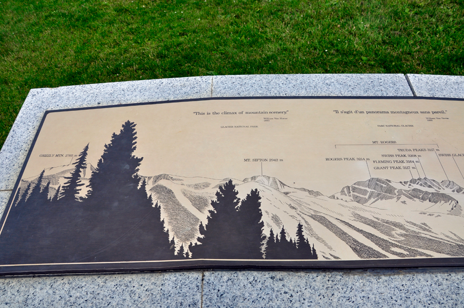
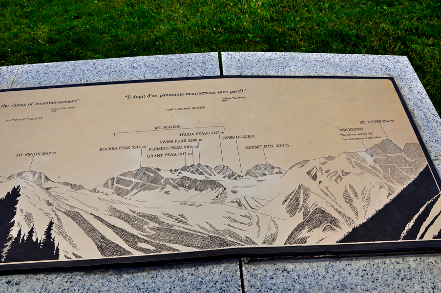
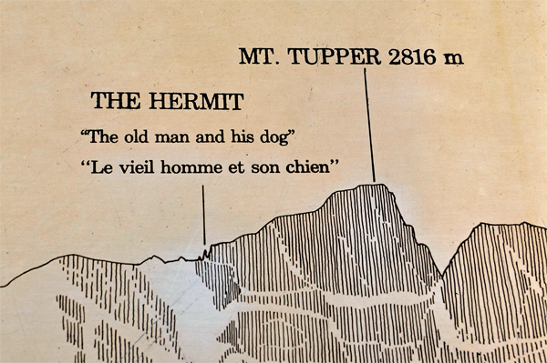
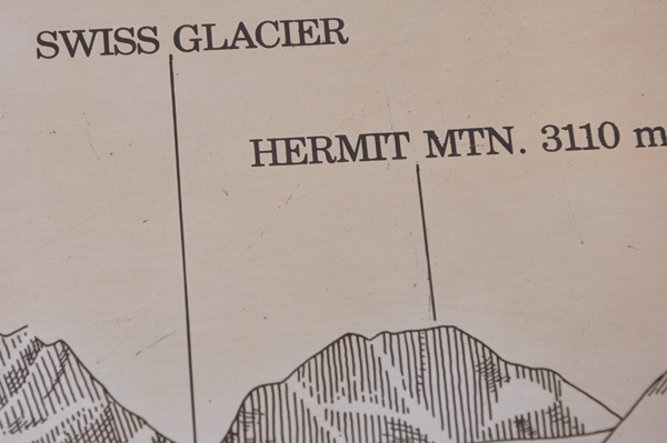
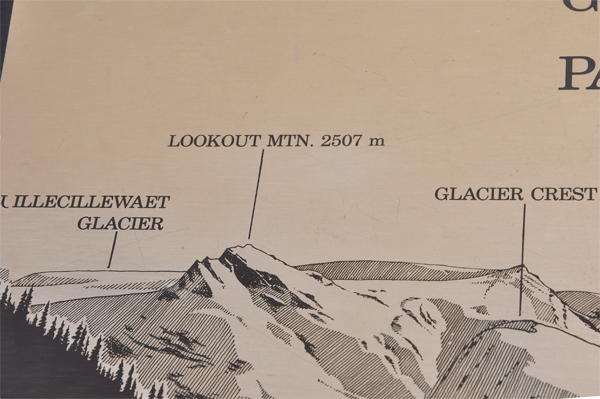
Below: The sign shown below
was too big for one photo, so first here is the left side of it, followed
by the right side of it below. It identifies mountains and glaciers
seen from Rogers Pass. |
|
|
 |
 |
 |
 |
 |
 |
 |
 |
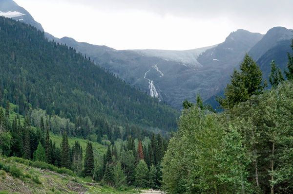
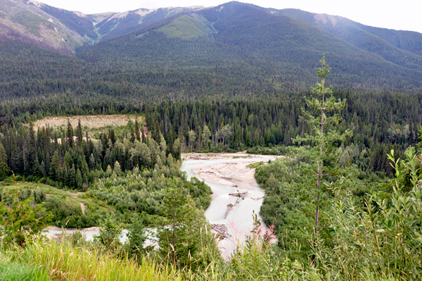
Below: A Waterfall and a
river seen while driving through Glacier National Park. |
 |
 |
 |
 |
 |
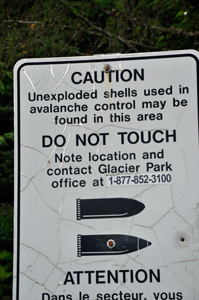
Below: Lee and Karen Duquette
were going to take a hike until they saw the below sign about unexploded
shells.
To keep the Highway open during the winter, the Royal Canadian Artillery
uses 105 mm howitzers to knock down the avalanches under controlled
circumstances so traffic is not caught in unexpected avalanches. |
 |
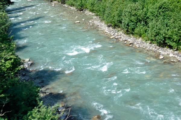
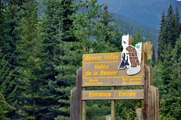
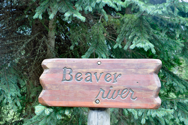
Below: The Beaver River is
the eastern egress from the Rogers Pass. Its valley is the route of
the Trans-Canada Highway and Canadian Pacific Railway on that side of
the pass. Its lower reaches are officially named Beaver Canyon.
The pass between the Beaver River and the Duncan River forms the dividing
line between the Selkirks and the Purcell Mountains. |
 |
 |
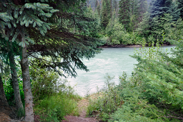
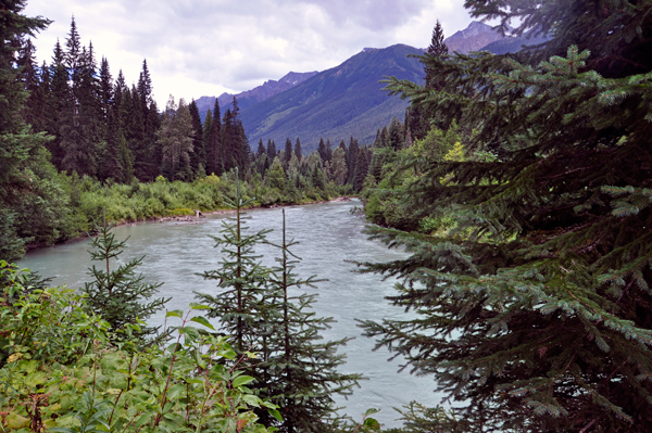
Below: The
view of Beaver River where the two RV Gypsies had a peaceful picnic
lunch. |
 |
 |
 |
 |