Two RV Gypsies: Full-Time RVers
return to the home index page
Table of Content for this website
Learn about Karen Duquette
email the two RV Gypsies please sign my guestbook
the two RV Gypsies in Alaska
The two RV Gypsies in Canada
Countries the two RV Gypsies have visited
Cruises the two RV Gypsies experienced USA RV travels
learn about Brian Duquette and my heartbreak
Flashback adventures of Karen Duquette Links to other travel websites campgrounds videosby  by the Two RV Gypsies

The two RV Gypsies
took a day trip on the Klondike Highway

from Whitehorse to Carcross

and then into Skagway, Alaska
(a 46 mile trip each way)
July 3, 2016

NOTE: This page make take a minute or two for the pictures to load. Please be patient. Thank you. Also, remember to adjust the monitor percentage on your screen for the best viewing access. If needed, press F5 to refresh, or use the home button for help navigating this large website.

Southern Lakes and Klondike Hwy map

sign- welcome to the Southern Lakes

(DARK RED #2 ON THE ABOVE MAP) - The two RV Gypsies paused to admire Emerald Lake in the southern Yukon, notable for its intense green color. It is located on the South Klondike Highway at mile 73.5, measured from Skagway, Alaska. The color derives from light reflecting off white deposits of marl, a mixture of clay and calcium carbonate, at the bottom of the shallow waters.

The high concentration of calcium carbonate in the water here comes from limestone gravels eroded from the nearby mountains and deposited here 14,000 years ago by the glaciers of the last ice age. Glacial erosion was likewise responsible for scooping out the shallow lake bed.

Hypoxic conditions during the summer may contribute to carbonate deposition and marl formation.
Above quote from Wikipedia, the free encyclopedia.

Emerald Lake

Emerald Lake

Mile 73.1: The main viewing area for Emerald Lake, known by many as "the most-photographed lake in the Yukon".

Emerald Lake

Emerald Lake

Emerald Lake

Emerald Lake

Carcross Desert and Dunes - the World's Smallest Desert

(Orange #21 on the above map) Mile 66.9: Viewing area and access to the Carcross dunes system, with this part of it commonly called "The World's Smallest Desert" - one square mile of rolling dunes.

The dune system is home to several rare plants including Baikal Sedge (Carex sabulosa) and Yukon Lupine (Lupinus kuschei).

Carcross is also home to a moth with a name that is hard to pronounce - GNORIMOSCHEMA MOTH. Interpretive signs are shown below.

sign about the dunes
sign about the ancient environment
sign about patterns in the dunes sign: the dunes are moving
sign about insects and flowers Lee Duquette at  Carcross Desert Dunes
Karen Duquette at  Carcross Desert Dunes the two RV Gypsies at Carcross Desert Dunes

The two RV Gypsies enjoyed the beauty of Carcross Desert and watched people glide towards the ground with their parachutes.

Carcorss Desert parachute
incoming parachute another incoming parachute
incoming parachute Carcross Desert Dunes
Carcross Desert Dunes Carcross Desert Dunes

history clipart bookMile 65.6: Downtown Carcross, had 436 residents as of the December 2014 report. This is one of the oldest communities in the Yukon, first settled during the rush to the Klondike. On July 29, 1900, a Golden Spike was driven at the north end of the railway bridge to celebrate completion of the railway. Carcross became a major transportation hub during the 1920s, with significant railway, sternwheeler and aircraft traffic serving the southern Yukon and northern British Columbia.

map showing location of Carcross, Yukon

Carcross, originally known as Caribou Crossing, is an unincorporated community in Yukon, Canada, on Bennett Lake and Nares Lake. It is home to the Carcross/Tagish First Nation.

It is 46 miles south-southeast by the Alaska Highway and the Klondike Highway from Whitehorse. The south end of the Tagish Road is in Carcross. Carcross is also on the White Pass and Yukon Route Railway.

history bookCaribou Crossing was a fishing and hunting camp for Inland Tlingit and Tagish people. 4,500-year-old artifacts from First Nations people living in the area have been found in the region.

Caribou Crossing was named after the migration of huge numbers of caribou across the natural land bridge between Lake Bennett and Nares Lake. That caribou herd was decimated during the Klondike Gold Rush, but a recovery program raised the number of animals to about 450.

The modern village began in 1896, during the Klondike Gold Rush. At the time, Caribou Crossing was a popular stopping place for prospectors going to and from the gold fields of Dawson City.

Caribou Crossing was also a station for the Royal Mail and the Dominion Telegraph Line, and it served as a communications point on the Yukon River.

In 1904, Caribou Crossing was renamed Carcross as a result of some mail mix-ups with the Cariboo Regional District in nearby British Columbia.

Silver mining was promoted nearby in Conrad, Yukon in the early 1900s, but there was little to be found and mining efforts soon ended. Mineral exploration continues today, but tourism is far more important to the economy of the community. The book Fractured Veins & Broken Dreams by Murray Lundberg details a nearly complete history of Conrad.

sign- welcome to Carcross-Tagish Fist Nation
Historic Downtown Carcross sign Historic Downtown Carcross sign
a metal art of sternwheeler Tutshi metal art of the Yukon Route Railway train

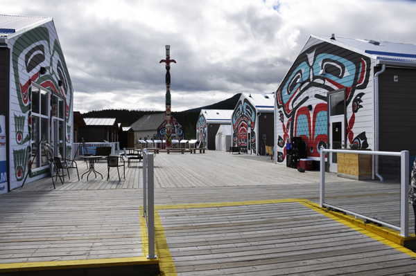
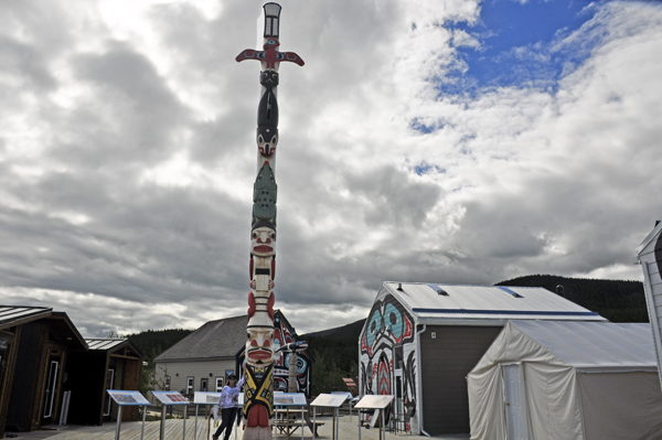
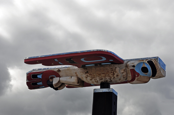
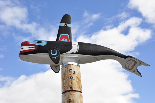
Carcross Commons and a tall totem pole, plus a bit of shopping - espresso, coffee and homemade goodies.

Carcross Commons and a tall totem pole Carcross Commons and a tall totem pole
Karen Duquette at the base of the totem pole art
top of a totem pole top of a totem pole

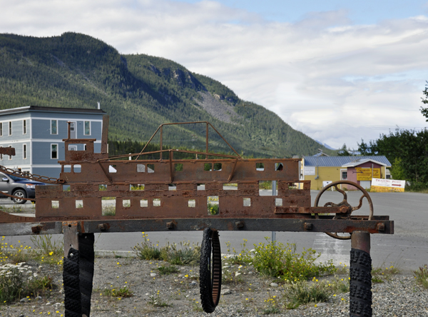
BELOW: The wooden hull of the sternwheeler Tutshi, which was built in 1917.

The wooden hull of the sternwheeler Tutshi

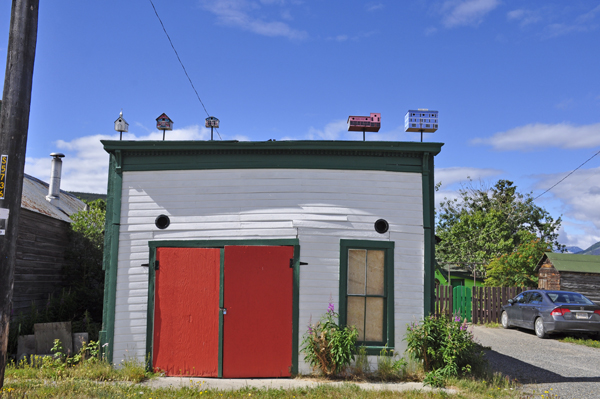
BELOW: Miniature replicas of the local buildings are on top of a small building and serve as birdhouses.
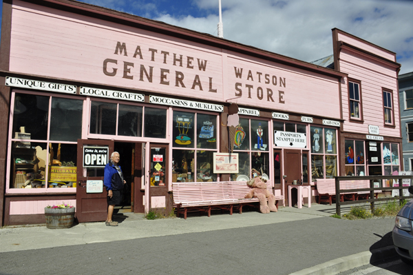
bird houses on a building roof

The Matthew Watson General Store is one of Yukon's longest operating businesses. Following a 1909 fire that destroyed much of downtown Carcross, the store was reconstructed from two buildings moved to Carcross from the dwindling mining communities of Conrad and Bennett. Matthew Watson, a prospector who traveled over the Chilkoot Pass in 1899, bought the store in 1911. He carried general merchandise and miner’s supplies, and outfitted hunting parties. Watson and his descendants continued to operate the store until 1982, when it was purchased by Stan and Jean Tooley. When the Tooleys took over, the store still contained elegant top hats in silk-lined boxes and dusty jars of liniment promising cures for everything from sprains to baldness.

Matthew Watson General Store shoplifters will be shot sign

Below: The Caribou Hotel, dating to 1910, is one of the oldest buildings in The Southern Lake Region. The hotel was also known for Polly the Parrot who lived here from 1918 to 1972 and entertained the guests with his rendition of "I Love you Truly" and "Springtime in the Rockies. The Caribou Hotel is a designated Yukon Historic Site.
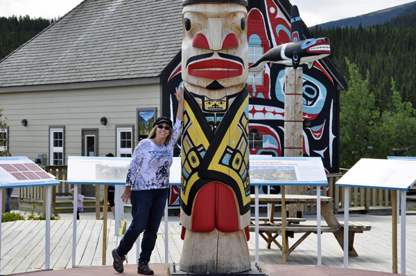
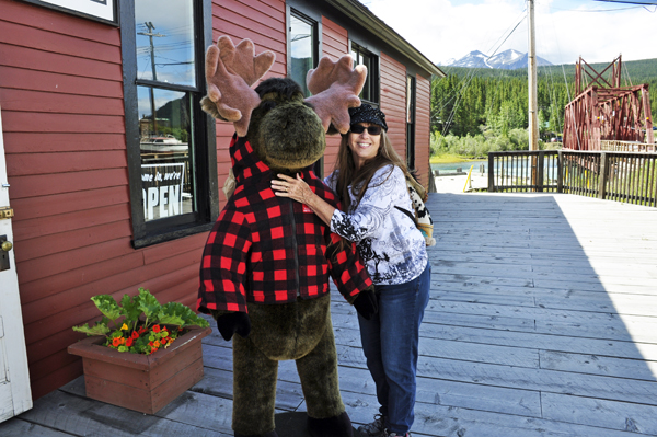
The Caribou Hotel center of Carcross Village

BELOW: Karen Duquette made a new friend.

Karen Duquette made a new friend.

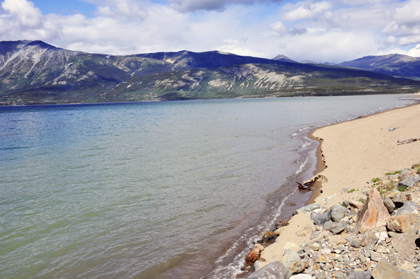
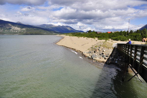
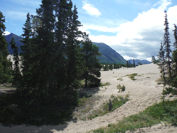
The two RV Gypsies walked on the $900,000 footbridge across the Nares River and enjoyed the view of the TWO-mile-long fine sand beach at Carcross (great for both views and fishing).

Nares River Nares River and bridge
Nares River Nares River

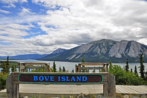
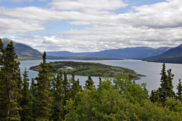
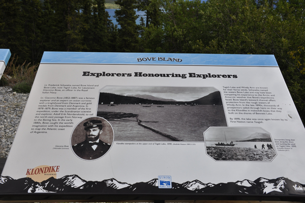
Bove Island : Carcross, Yukon, Canada

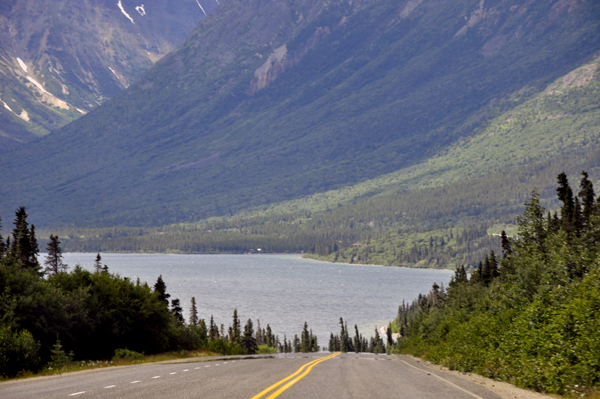
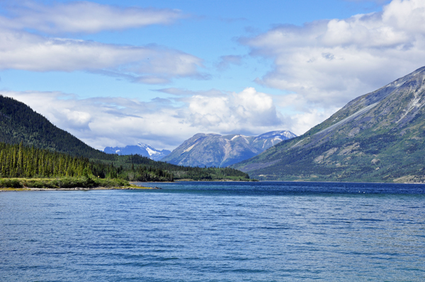
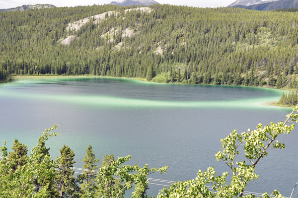
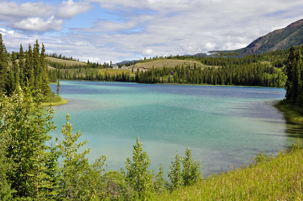
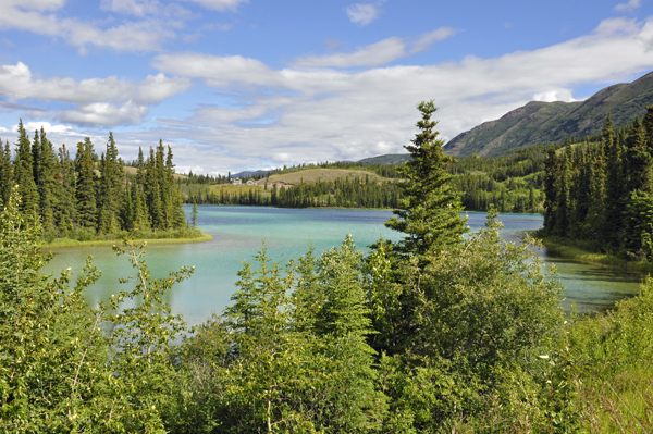
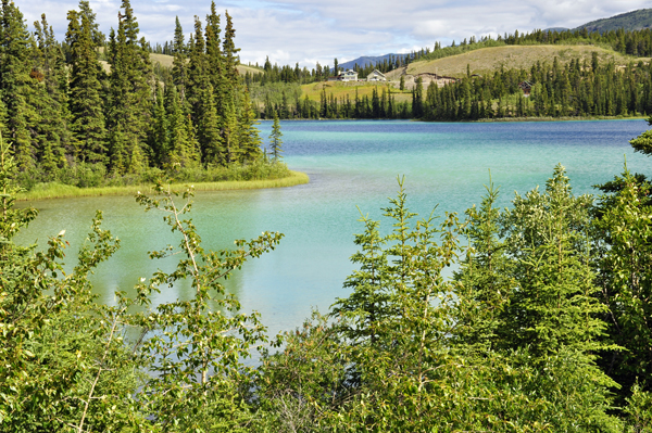
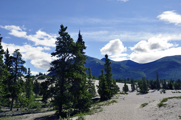
Mile 59.0: Bove Island viewpoint - a large parking area with interpretive signs and a broad view down Tagish Lake, which flows into the Yukon River. During the Gold Rush, many boats were wrecked here when they came out of calm Nares Lake into high winds on Windy Arm.

Bove Island is a sightseeing lookout destination located south of the community of Carcross on the Southern Klondike Highway in the Yukon Territory of Canada. The lookout provides some far reaching views overlooking the Windy Arm of Tagish Lake and Bove Island.

The lookout platform is easily visible from the highway. There is a small pull-out parking area, interpretive signs and a large wooden platform with rails and benches. The interpretive billboards explain the history of the region and assists in identifying local landmarks.

The Windy Arm of Tagish Lake was once part of a historic paddle route during the Yukon Gold Rush. Miners would arrive in Skagway, Alaska, USA and hike the Yukon Pass to Bennett Lake. From Bennett Lake miners would paddle Nares, Tagish and Marsh Lakes to the Yukon River and Dawson City.

From the lookout, perched on a rocky ridge, one can enjoy views of the lake and surrounding mountains. Mountains like Mount Conrad, Nares Mountain and Lime Mountain. The lookout is a good opportunity to view a portion of this historic route exploring Tagish Lake.

Prior to the Yukon Gold Rush the chain of lakes were used by the First Nation people of the Yukon. The local First Nation tribes of the Tlingit and Tagish paddled these same waters for many years hunting and establishing trade with neighboring villages.

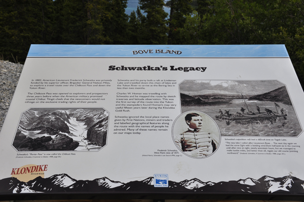
The first non First Nation explorer arrived in the region in 1883. It was then that an American by the name of Schwatka was commissioned by the American Government to survey the transportation route leading to the Yukon River. Schwatka named the island Bove after a lieutenant in the Italian Navy.
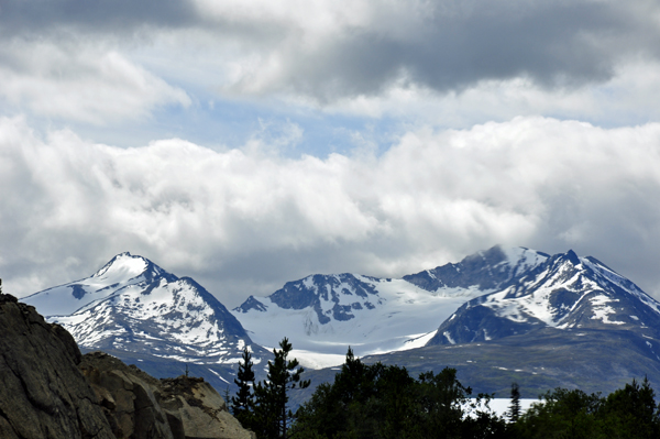
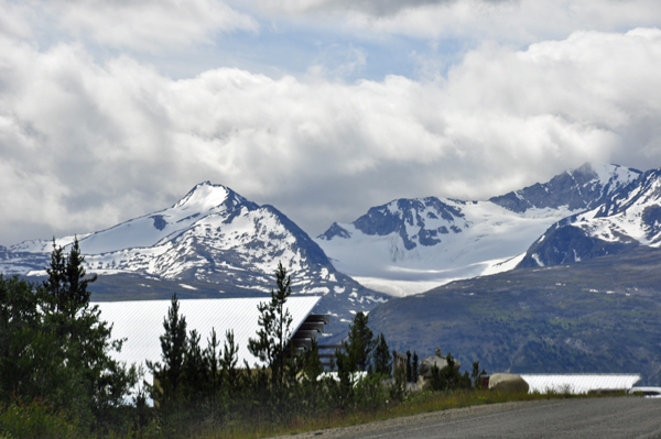
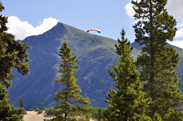
Bove Island sign
Bove Island
Bove Island sign - Schwatka's Legacy
sign - Bove Island explorers

Mount Conrad

approaching Mount Conrad
Mount Conrad
a glacier on Mount Conrad

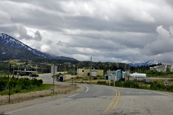
Mile 49.9: "Welcome to the Yukon" and leaving British Columbia. Dall sheep and mountain goats are sometimes seen on Dall Peak - up to 20 animals at a time is not uncommon, but the two RV Gypsies did not see any wildlife.
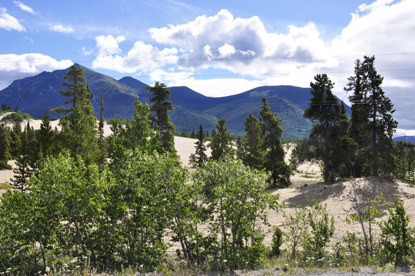
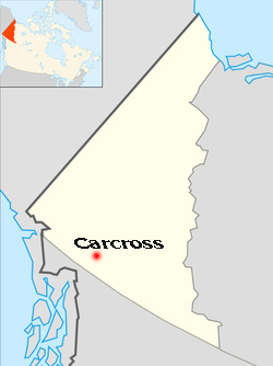
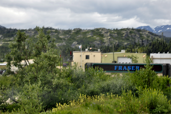
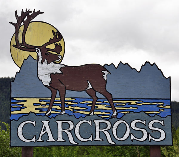
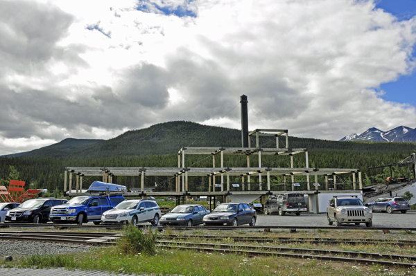
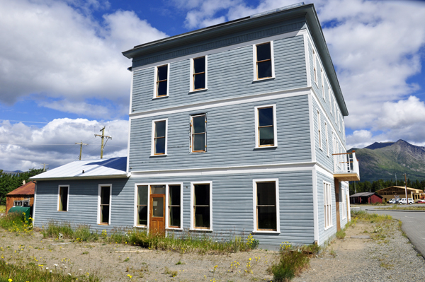
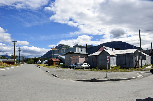
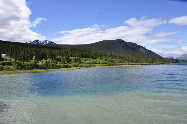
YUKON SUSPENSION BRIDGE
'604.628.5660 opens at 10 a.m.

Mile 29.5: The highway starts following the Tutshi River (pronounced TOO-shy) for about 2 miles. The river is popular with rafters and kayakers, even though access is difficult. The Yukon Suspension Bridge goes over the canyon here - opened in May 2006, this nature/history interpretive center also includes a cafe serving their famous bison chili and other items, and a gift shop.

The biggest reason the two RV Gypsies took the day trip to Carcross was to have the opportunity to walk on The Yukon Suspension Bridge, a world-class visitor attraction dedicated to providing an excellent overview of the history and nature of the areas surrounding its location, in museum quality outdoor interpretive exhibits. However, the two RV Gypsies arrived there just before 1 p.m. on Sunday, July 3, 2016 and the bridge was just being closed for the day. A major disappointment.

the Yukon Suspension Bridge sign
the Yukon Suspension Bridge entry

Since the Yukon Suspension Bridge was closed, the two RV Gypsies did not get to cross over the white-water rapids 65 feet above the Tutshi River and Canyon on the custom built footbridge, which would have been an exhilarating visit to this part of Canada's vast north. There is a fence all around the area, so the two RV Gypsies could only get a brief glimpse of the bridge, and no view of the water - as seen in the photo below.

the Yukon Suspension Bridge

Mile 22.7: Then the two RV Gypsies crossed Canada Customs post at Fraser. This customs is only open 8 a.m. to midnight Pacific Time. All persons entering Canada from the U.S. must stop and report, so there was no need for the two RV Gypsies to stop at this point until on the way back from Skagway.

look below

continue on to Skagway, Alaska From here, the two RV Gypsies went to Skagway, Alaska. There will be a link at the bottom of the Skagway page to return to the Yukon menu.