Lee
and Karen Duquette, |
|
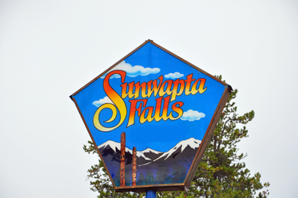
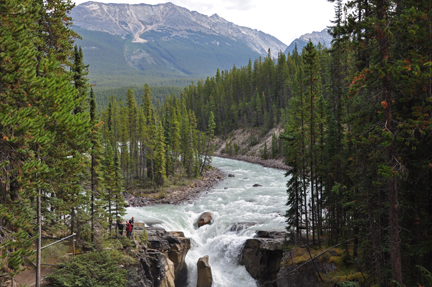
NOTE: Most of the photos below are from 2009 (the smaller photos), but a few have been added from 2015 (the bigger photos). Karen Duquette did not take a lot of new photos in 2015 because there was not much change in the falls.Sunwapta Falls is a pair of waterfalls of the Sunwapta River in Jasper National Park, Alberta, Canada. The falls are accessible via a 600-metre (2,000 foot) access road off the Icefields Parkway, which connects Jasper and Banff National Parks. The falls have a drop of about 18.5 metres (61 feet).Sunwapta Falls is 33 miles from the town of Jasper. Sunwapta means "turbulent river" in the language of the Stoney Nation, which is a great description for this unpredictable watercourse plummeting over the cliffs into a deep canyon. They are class 6 rapids. |
|
 |
 |
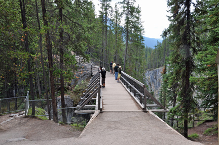
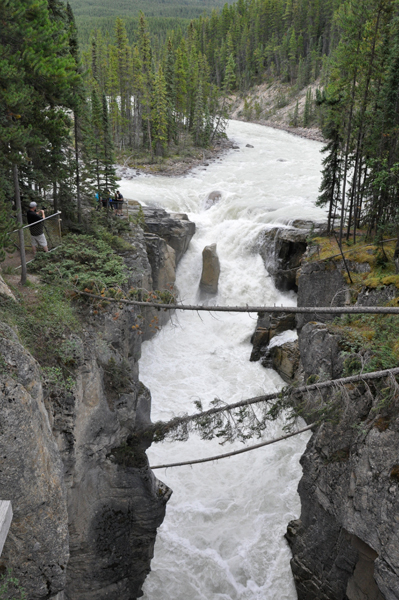
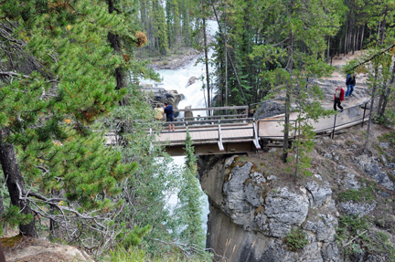
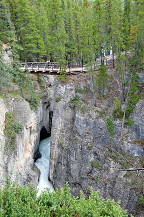
| There are many ways to view Sunwapta Falls: from the viewing bridge - the view is quite different on each side of the bridge, or you can be on a lower cliff to the right of the bridge, or on a higher cliff to the left of the bridge. | |
 |
|
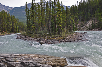
Below:
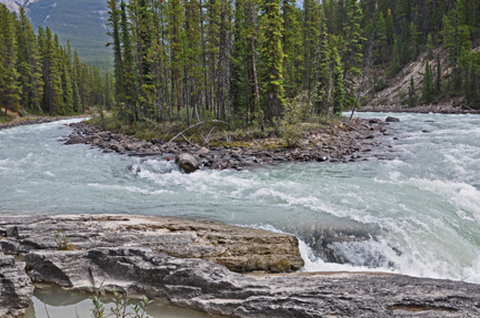
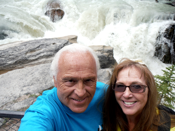
Lee and Karen Duquette viewed the top of the falls as it came around
a small island. |
|
 |
 |
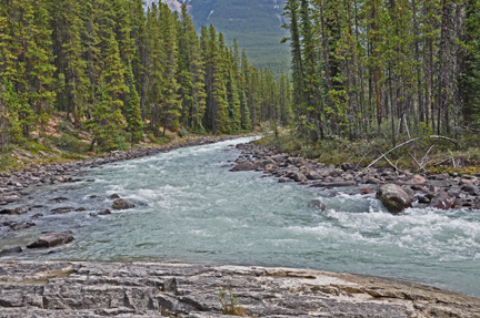
Below: The left side
of the small island |
|
 |
|
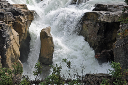
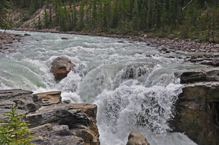
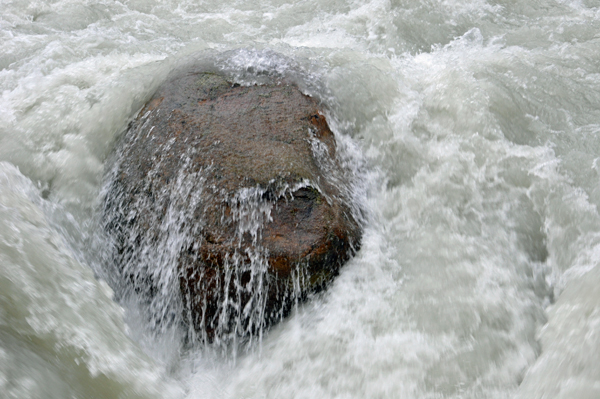
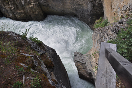
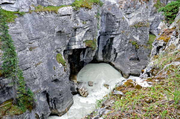
| Below: This photo was taken by Karen Duquette from the bridge and shows people viewing the top of the falls from the lower cliff. Notice the small round rock and the tall rock in the middle of the falls. | |
 |
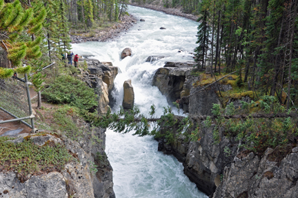 |
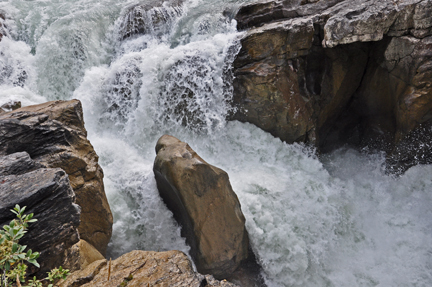
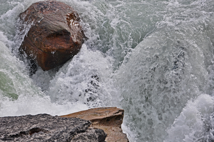
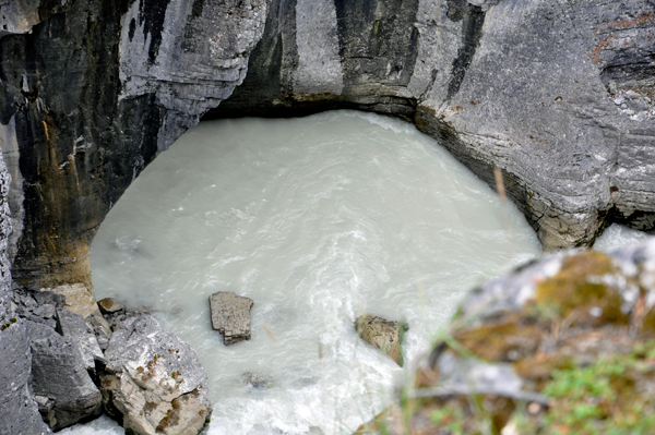
Below: Closer views of
the two rocks in the photos above |
|
 |
 |
 |
 |
 |
|
 |
 |
 |
 |
 |
|
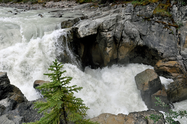
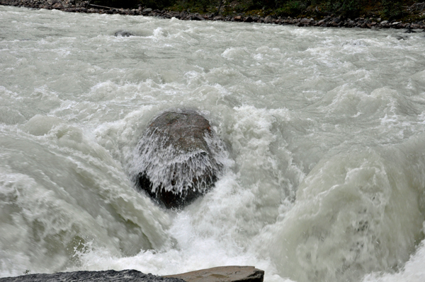
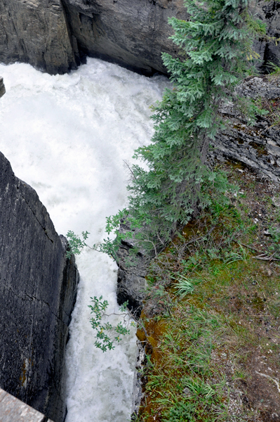
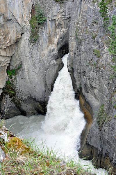
| Below: Karen Duquette took a closer view of the area just below the two rocks - and just before the water goes under the viewing bridge to the other side by the tall cliffs. | |
 |
 |
Below: A view of the
water after it goes under the bridge towards the tall cliffs |
|
 |
 |
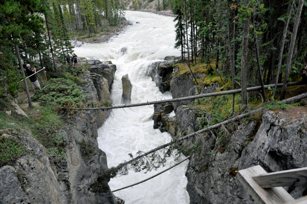
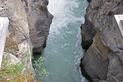
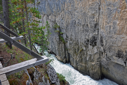
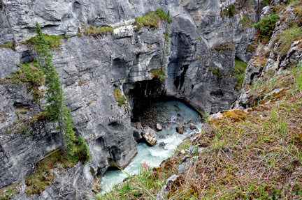
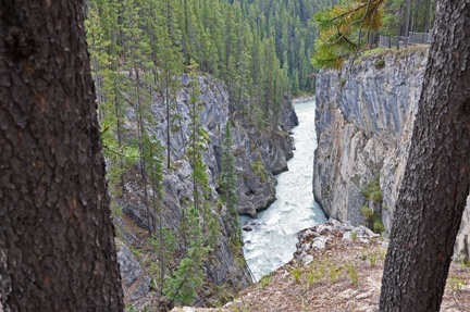
Below: Then the water
continued to flow between two cliffs |
|
 |
 |
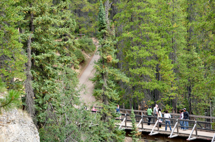
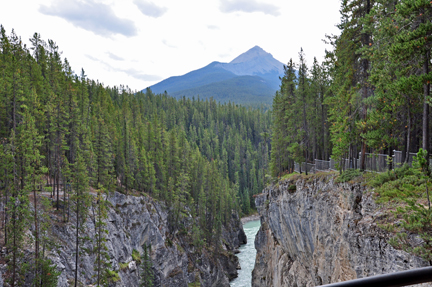
Below: The trail that
goes from the bridge to the top of the cliff shown above |
|
 |
 |
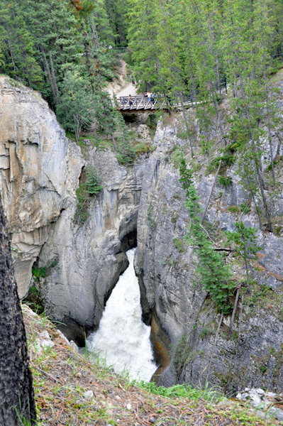
Below: Looking back at
the bridge from the upper cliff |
|
 |
|
 |
 |
 |
 |
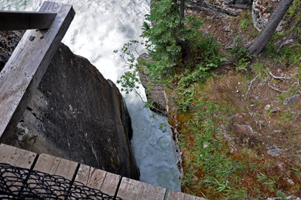
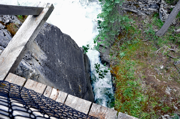
| Below: Karen Duquette looked straight down from the upper cliff | |
 |
|
 |
 |
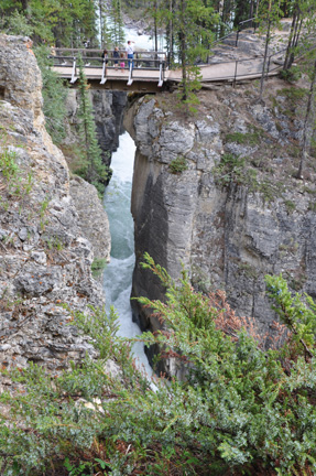
| The photo below shows people at the top of the upper cliff looking down at the bridge. Karen Duquette took this photo from a curve on the upper cliff. | |
 |
|
Below: Lee and Karen
Duquette looked down from the upper cliff to see the water flowing to
a place unseen. |
|
 |
 |
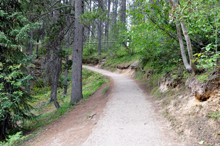
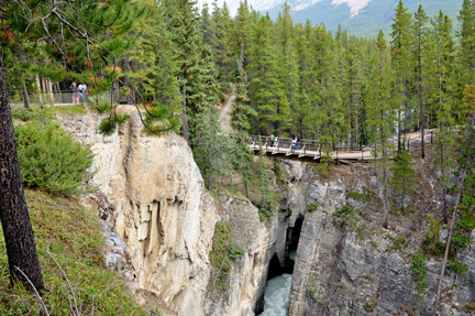
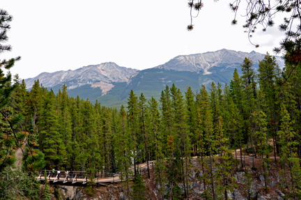
| The photo below shows the bridge and the start of a hiking trail that probably leads to many more different views of the water. It is a 2.0-mile out-and-back trail near Improvement District No. 12 , Alberta. Generally considered a moderately challenging route, it takes an average about of one-hour to complete. This is a very popular area for birding, hiking, and running. But Lee and Karen Duquette did not take this trail. | |
 |
|
 |
This is not a linear website, so visitors always have options of where to navigate next. Below are three of those options. Plus the main navigational buttons for this very large website. |
|
OR |
|
OR |
|
 Visit sites in the order they happened and
 ORContinue Navigation in any year, any place, in the
order of your choice |
|||||

|
|||||
 |
 |
 |
 |
 |
 |
 |
 |
 |
 |
 |
 |
 |
 |
 |
 |
 |
 |
 |
 |
 |
 |
 |
 |