 |
 |
 |
 |
 |
 |
 |
 |
 |
 |
 |
 |
 |
 |
 |
||
 |
|||||||
Two RV Gypsies: Full-Time RVers
(and Professional Travelers)
| |
|
|
|
|
|
|
|
|
|
|
|
|
|
|
||
|
|||||||
| Menu for photos/history
of the two RV Gypsies in Canada in 2009 |
There is NOT a linear website, so you always have options of where to go on this massive website. |
| BRITISH COLUMBIA, CANADA - May 2009 - |
| British Columbia is Canada's most westerly - and 3rd largest- province. BC stretches 813 miles from its southern border with the USA to the northern boundary with the Yukon Territory. It is bounded on the east by Alberta and on the west by the Pacific Ocean. Population about 4,113,487 - area: 364,764 square miles - Capital is Victoria. |
| The Yukon
Territory |
|
| NOTE: The
two RV Gypsies were in Alaska - June 5 through August
20 - (you can see these photos by choosing the Alaska button at the top
of this page - but for now, please continue on with the Canada journey) |
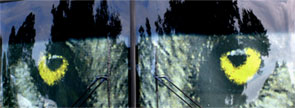
August 20, 2009 - The two RV Gypsies left Alaska and camped in Stewart, British Columbia - which is on the borderline of Hyder, Alaska where they got up close and personal with grizzly bears. |
BRITISH COLUMBIA,
CANADA |
Prince George |
ALBERTA,
CANADA & The Icefield Parkway |
| Alberta is bounded to the west by British Columbia, to the south by Montana-USA, to the east by Saskatchewan and to the north by the Northwest Territories. Population about 3,290,350. Capital is Edmonton. Fantastic Scenery everywhere - the best scenery the two RV Gypsies have ever seen! |
| BRITISH COLUMBIA, CANADA August 28, 2009 |
 Then
the two RV Gypsies re-entered the USA - Montana, Wyoming, Glacier National
Park, Yellowstone National Park, Montana's best kept secret, then the Badlands
- and Iowa for RV repairs - and more .........so please continue....................... Then
the two RV Gypsies re-entered the USA - Montana, Wyoming, Glacier National
Park, Yellowstone National Park, Montana's best kept secret, then the Badlands
- and Iowa for RV repairs - and more .........so please continue....................... |