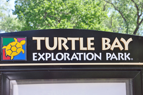
| Turtle Bay Exploration Park is a 300-acre campus
containing educational and entertaining activities that interpret the relations
between humans and nature. The Park tells the stories of the region and
its people through a museum and art gallery, wildlife exhibits, forest camp,
a summer butterfly house and aviary, amphitheater, Arboretum and Gardens.
It is also adjacent to the Sacramento River and houses the Sundial Bridge. |
|
|
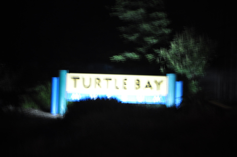
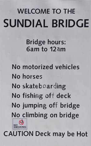
| Below: The two RV Gypsies visited the Sundial
Bridge both in the daylight and again in the evening, as can be seen by
the Turtle Bay signs below, first photographed in daylight, then again in
the evening. |
|
|
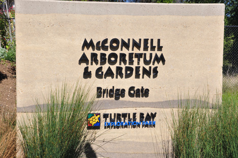
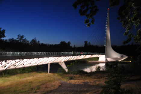
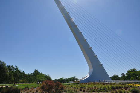
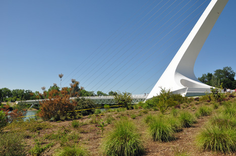
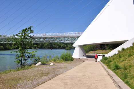
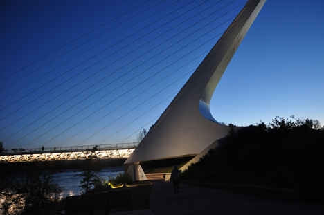
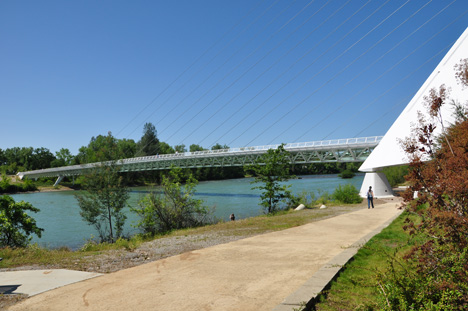
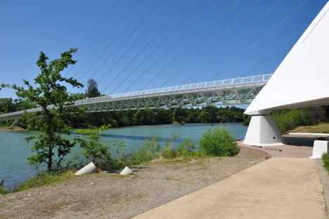
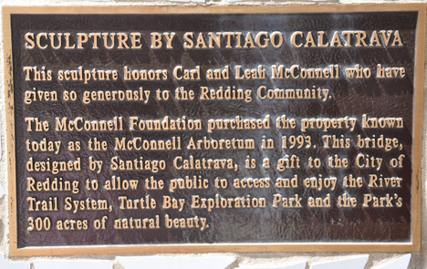
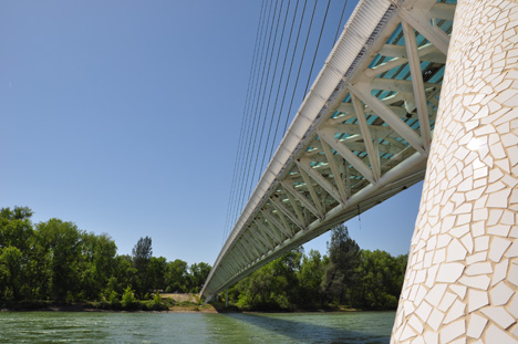
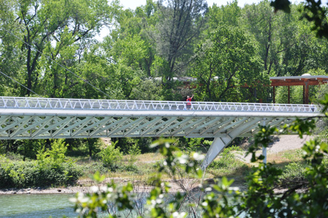
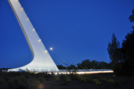
| Below: Located on the Sacramento River in Redding,
the Sundial Bridge is California's newest icon. Redding commissioned world
famous Spanish architect, Santiago Calatrava (architect for the Athens Olympic
Stadium) to design a pedestrian bridge over the Sacramento River, linking
the Turtle Bay Exploration Park's Museum to its Arboretum and Gardens, and
as a trail head for Redding's extensive Sacramento River National Recreation
Trail. (more information below) |
|
|
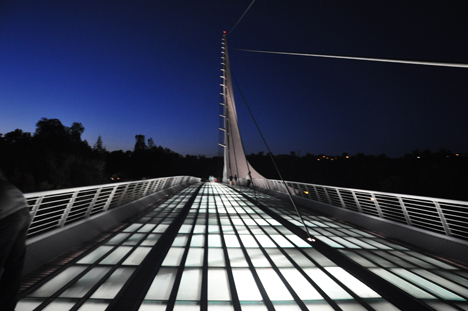
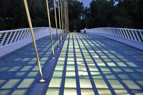
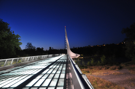
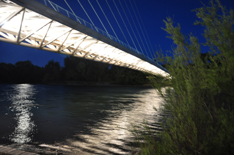
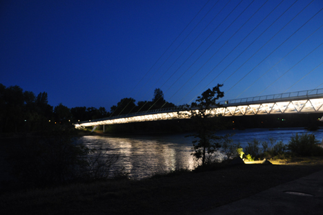
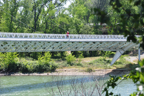
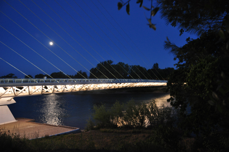
| Below: The best views of the Sundial Bridge
itself were taken in the evening, because there were less people on the
bridge, and the bridge was lit at night. All throughout this page, you will
see views of the Sundial Bridge from various angles, both during the daytime
and at night. Similar shots taken by daylight and evening are shown side-by-side.
Also below are photos of the sundial plaque, shadows and time gauge; along
with some fabulous moon shots. So scroll down slowly and enjoy. |
|
|
|
|
|
|
|
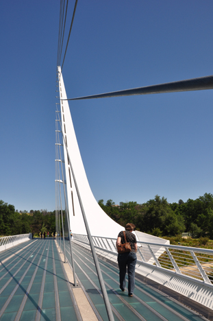
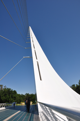
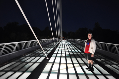
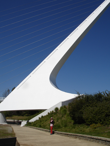
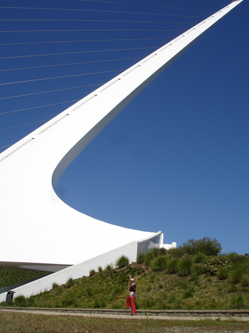
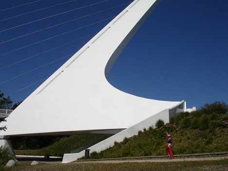
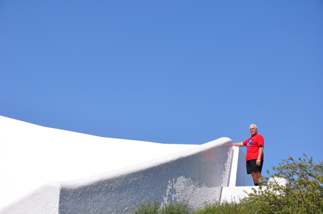
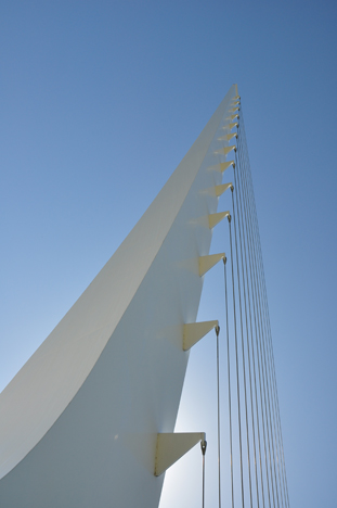
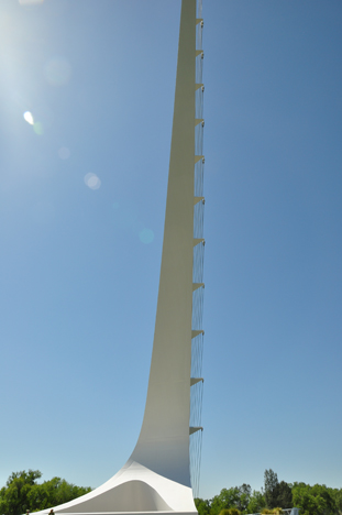
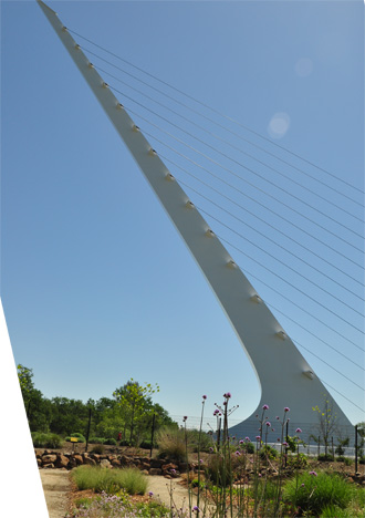
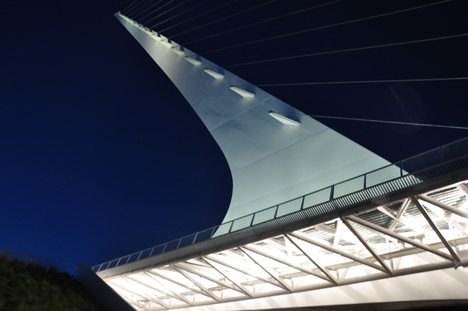
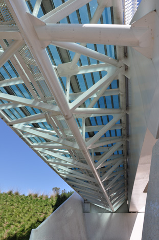
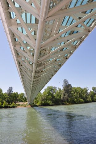
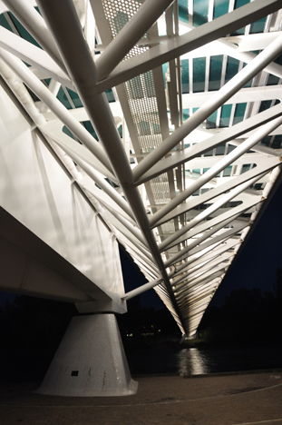
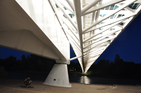
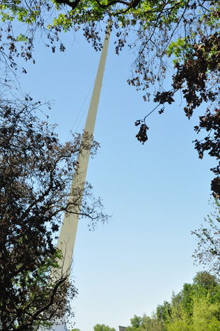
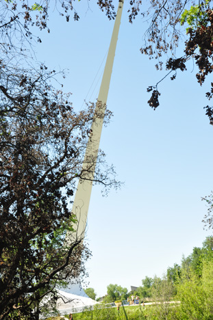
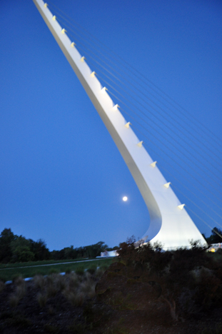
This 710-foot-long bridge spans the river
without footings in the water. The walking surface is translucent
glass, so as not to cast a dark shadow on the spawning gravels below the
bridge. This design achieved this goal with an inclined 21-story
tall pylon built on the north bank of the river that supports the
entire river span. Also, because of the exact north-south orientation of
the bridge, the pylon serves as the upright element of a sundial, making
it the worlds tallest sundial. |
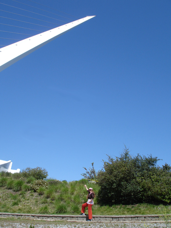
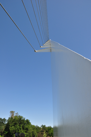
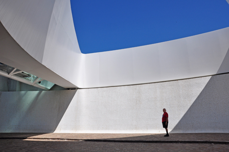
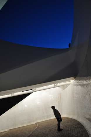
Below: Different
views of the Pylon described above |
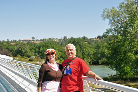
Karen Duquette at the
bridge in the evening |
|
|
Below: A day
view and evening of approximately the same area of the pylon |
|
|
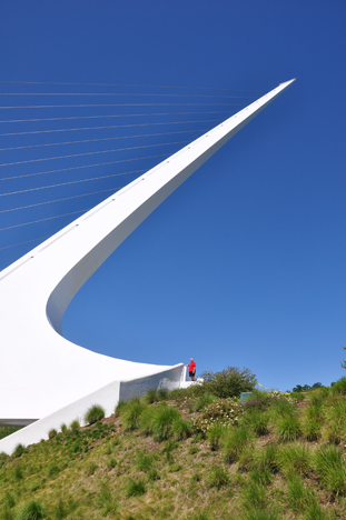
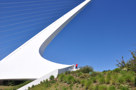
Below: The
photo below on the left shows Karen Duquette pointing up to where Lee
was standing in the below photo on the right. |
|
|
|
|
|
|
|
|
|
|
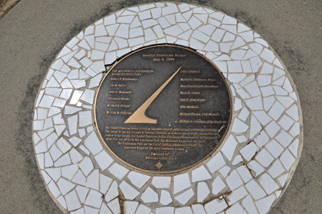
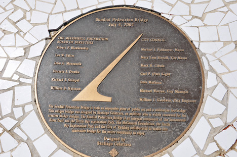
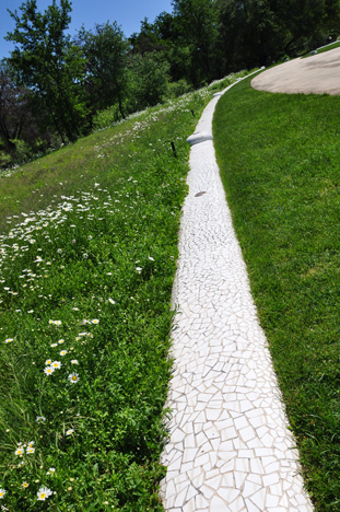
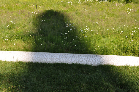
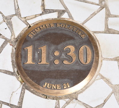
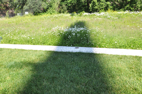
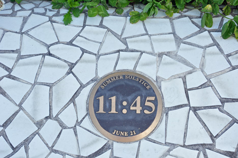
Below: The Sundial plaque,
shadow, and time line |
|
|
Below: Because of the exact
north-south orientation of the bridge, the pylon serves as the upright
element of a sundial, making it the worlds tallest sundial. Below are
photos of the "timeline" with time markers. The shadow from
the pylon falls upon it and tells the time. |
|
|
|
|
|
Below: Lee Duquette in the
same area during the day, and at evening. (Lee is just a shadow in the
night shot). |
|
|
|
|
|
|
|
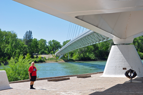
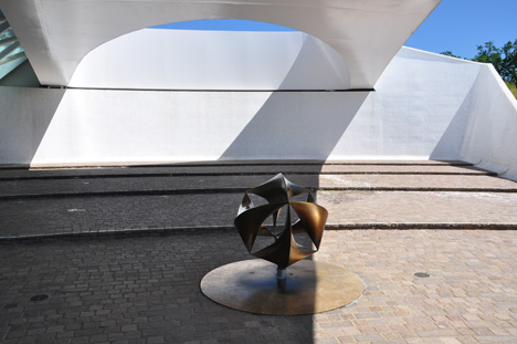
Below: Lee Duquette under
the bridge by the sculpture |
|
|
|
|
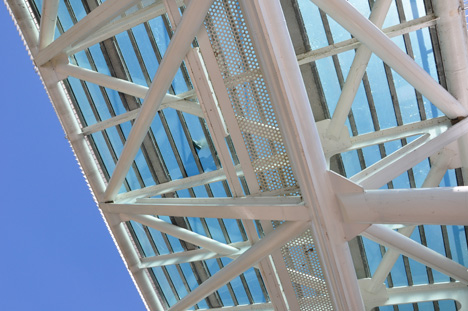
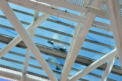
Below: Views from under
the bridge |
|
|
|
|
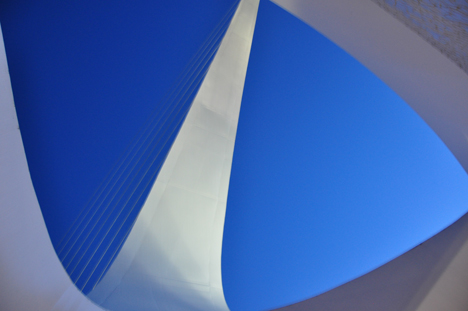
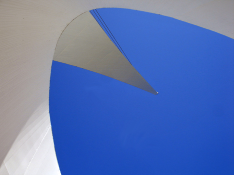
Below: Looking up, there
were people walking on the bridge. |
|
|
|
Below; Lee Duquette walked
under the bridge to look up at the pylon. |
|
|
|
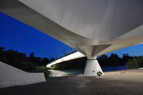
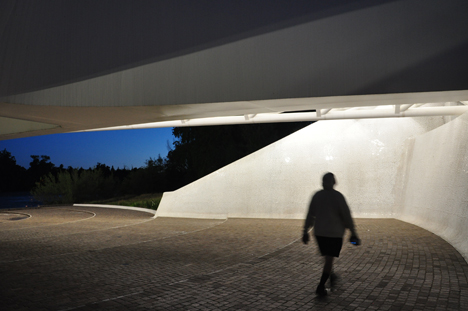
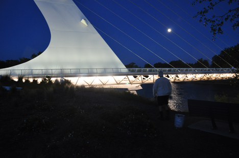
Left: Lee Duquette looked up at the pylon and sky from under the
bridge - night view
Below: looking up at the sky and the pylon from under the bridge |
|
|
Below: The two RV Gypsies
found the perfect spot for lunch. |
|
|
Below: Karen Duquette relaxed
at the lunch spot and photographed Lee Duquette on the Sundial Bridge
taking the lunch cooler back to the car. |
|
|
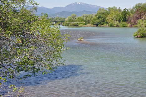
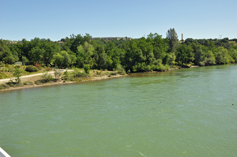
Below: Views of the Sacramento
River - taken from the Sundial Bridge |
|
|
|
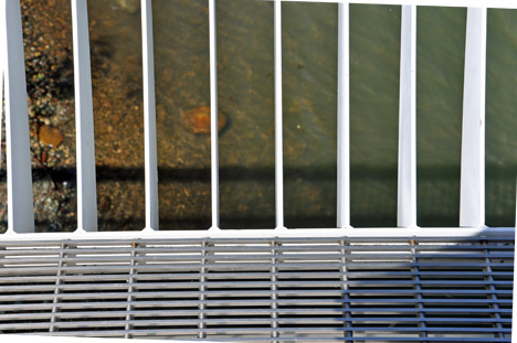
Below: Looking down into
the river through the side of the Sundial Bridge |
|
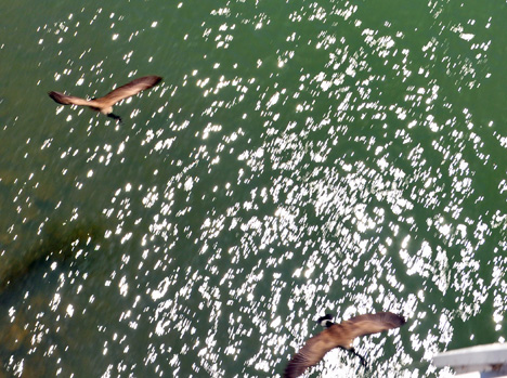
Below: Birds flying low
over the water - photo taken from the Sundial Bridge |
|
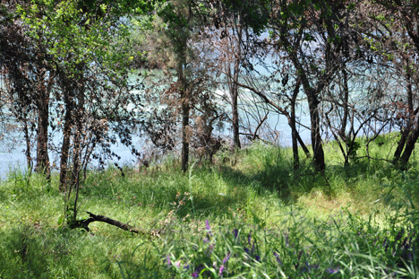
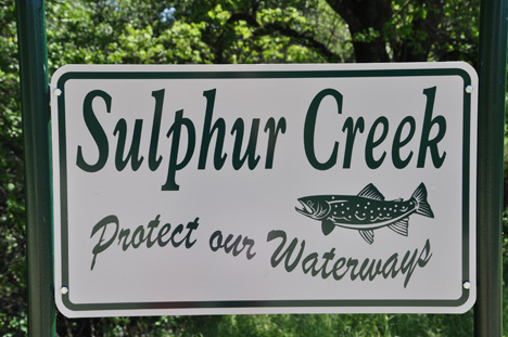
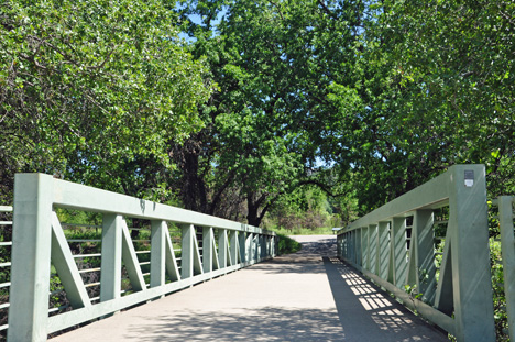
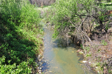
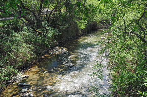
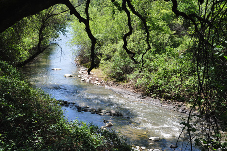
| Below: Sulphur Creek and Sulphur Creek Bridge
lead to a trail head for Redding's extensive Sacramento River National Recreation
Trail. |
|
|
|
|
|
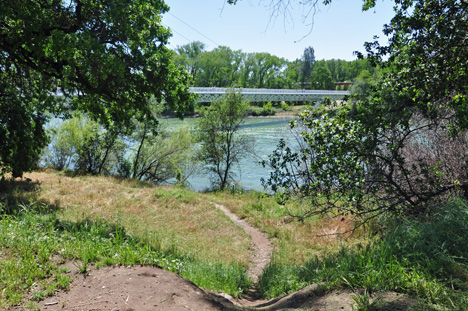
A peek at part of the Sundial
Bridge pylon from the hiking trail behind Sulphur Creek Bridge |
|
|
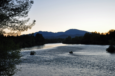
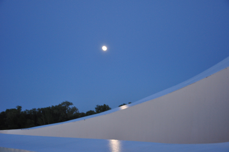
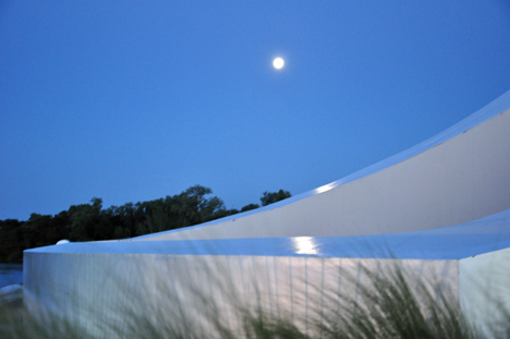
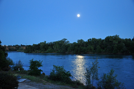
Below: A partial view of
Sundial Bridge and river views under the early evening moonlight |
|
|
|
|
|
|
|
Menu for the two RV Gypsies
in California - April 2009 |
California photos are in 28 separate sections found below. Some sections may have more than one page so that the photos will upload faster.
You may visit these sections in any order you choose. Each section will have this menu so that visitors do not have to keep returning here in order to continue the California adventures. There is also a link to Oregon at the very bottom of the California menu.
|
|
|
|
|
|
|
|
|
|
|
|
|
|
|
|
|
|
|
|
|
|
|
|
|
|
|
|
|
Sundial Bridge (this page)
|
|
|
|
|